File:14.76574W 13.53448N.png

本预览的尺寸:800 × 597像素。 其他分辨率:320 × 239像素 | 640 × 478像素 | 1,024 × 764像素 | 1,278 × 954像素。
原始文件 (1,278 × 954像素,文件大小:1.11 MB,MIME类型:image/png)
| 描述 |
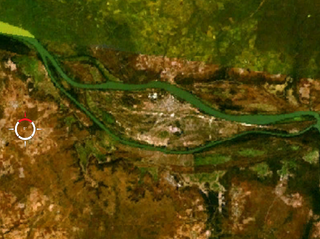
English: Janjanbureh Island |
| 来源 | NASA |
| 作者 | 相片: NASA |
| 本圖像屬於公有領域,因其為NASA的World Wind衛星地圖瀏覽器的一張截圖,且使用了公有領域圖層,如Blue Marble、MODIS、Landsat、SRTM、USGS、GLOBE等。
|
 |
文件历史
点击某个日期/时间查看对应时刻的文件。
| 日期/时间 | 缩略图 | 大小 | 用户 | 备注 | |
|---|---|---|---|---|---|
| 当前 | 2008年7月12日 (六) 12:28 | | 1,278 × 954(1.11 MB) | MichaelFrey | {{Information |Description={{en|Pasan Island and Deer Island, Gambia}} |Source=NASA |Date=get on 17.9.2006 |Author= |Permission= |other_versions= }} {{PD-WorldWind}} category:Satellite pictures of Gambia |
文件用途
以下页面使用本文件:
全域文件用途
以下其他wiki使用此文件:
- de.wikipedia.org上的用途
- en.wikipedia.org上的用途
- es.wikipedia.org上的用途
- fr.wikipedia.org上的用途
- gl.wikipedia.org上的用途
- hr.wikipedia.org上的用途
- ja.wikipedia.org上的用途
- pl.wikipedia.org上的用途