File:Enstone-airfield-the-grand-tour-gravel-test-track-20171223.svg

此SVG文件的PNG预览的大小:790 × 273像素。 其他分辨率:320 × 111像素 | 640 × 221像素 | 1,024 × 354像素 | 1,280 × 442像素 | 2,560 × 885像素。
原始文件 (SVG文件,尺寸为790 × 273像素,文件大小:1.86 MB)
摘要
| 描述 |
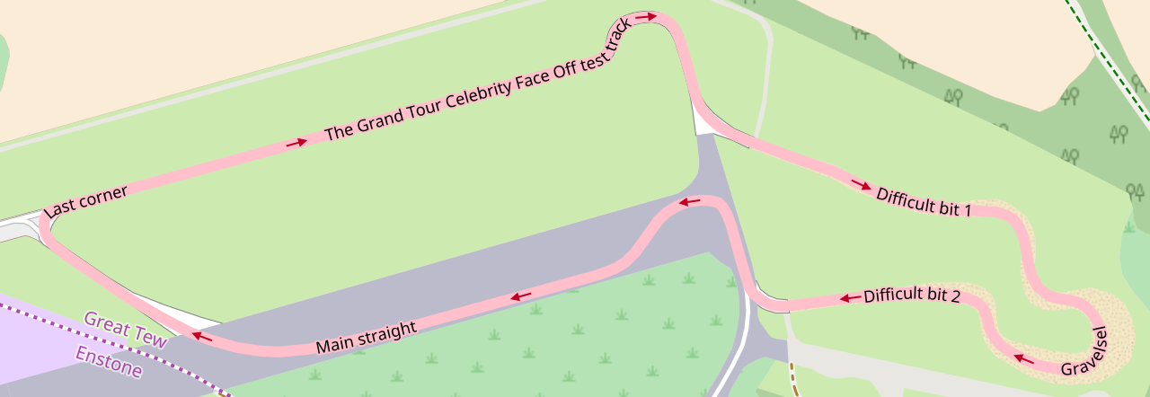
English: w:The Grand Tour (TV series) test track at the former w:RAF Enstone, home of w:Enstone Airfield. The course is constructed of sections of former test track, a redesign of an existing gravel course, and a section on the former main runway—joined together with new asphalt stub sections. Obtained with [1]. |
| 日期 | |
| 来源 | w:OpenStreetMap |
| 作者 | OpenStreetMap Contributors. |
| 相机位置 | | 在以下服务上查看本图像和附近其他图像: OpenStreetMap |
|---|
许可协议
| 此作品内含来自OpenStreetMap贡献者的地图资料,以开放数据库许可证(ODbL)释出。
对于从ODbL数据生成的地图,ODbL不需要任何特定许可。在2020年8月1日之前,OpenStreetMap基金会制作的地图图块已根据CC-BY-SA-2.0许可证授权。其他人制作的地图可能需要获得其他许可。 |
文件历史
点击某个日期/时间查看对应时刻的文件。
| 日期/时间 | 缩略图 | 大小 | 用户 | 备注 | |
|---|---|---|---|---|---|
| 当前 | 2017年12月23日 (六) 12:25 | 790 × 273(1.86 MB) | Sladen | User created page with UploadWizard |
文件用途
以下页面使用本文件:
全域文件用途
以下其他wiki使用此文件:
- cs.wikipedia.org上的用途
- de.wikipedia.org上的用途
- en.wikipedia.org上的用途
- fa.wikipedia.org上的用途
- ru.wikipedia.org上的用途