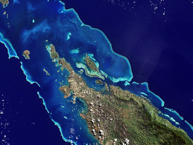
File:Lagoons and Reefs of New Caledonia May 10, 2001.jpg

本预览的尺寸:800 × 600像素。 其他分辨率:320 × 240像素 | 640 × 480像素 | 1,024 × 768像素 | 1,280 × 960像素 | 2,560 × 1,920像素 | 4,000 × 3,000像素。
原始文件 (4,000 × 3,000像素,文件大小:5.58 MB,MIME类型:image/jpeg)
文件历史
点击某个日期/时间查看对应时刻的文件。
| 日期/时间 | 缩略图 | 大小 | 用户 | 备注 | |
|---|---|---|---|---|---|
| 当前 | 2013年1月27日 (日) 01:05 |  | 4,000 × 3,000(5.58 MB) | Slick-o-bot | Bot: convert to a non-interlaced jpeg (see bug #17645) |
| 2008年7月27日 (日) 18:22 |  | 4,000 × 3,000(5.02 MB) | CarolSpears | {{Information |Description=NASA’s Landsat 7 satellite captured this image of Île Balabio, off the northern tip of Grande Terra, New Caledonia’s main island. In this natural-color image, the islands appear in shades of green and brown—mixtures of ve |
文件用途
以下页面使用本文件:
全域文件用途
以下其他wiki使用此文件:
- ar.wikipedia.org上的用途
- ast.wikipedia.org上的用途
- ca.wikipedia.org上的用途
- ceb.wikipedia.org上的用途
- cs.wikipedia.org上的用途
- de.wikipedia.org上的用途
- en.wikipedia.org上的用途
- en.wikibooks.org上的用途
- es.wikipedia.org上的用途
- eu.wikipedia.org上的用途
- fi.wikipedia.org上的用途
- fr.wikipedia.org上的用途
- gl.wikipedia.org上的用途
- he.wikipedia.org上的用途
- hr.wikipedia.org上的用途
- id.wikipedia.org上的用途
- it.wikipedia.org上的用途
- ka.wikipedia.org上的用途
- ko.wikipedia.org上的用途
- lt.wikipedia.org上的用途
- lv.wikipedia.org上的用途
- mt.wikipedia.org上的用途
- ne.wikipedia.org上的用途
- nl.wikipedia.org上的用途
- no.wikipedia.org上的用途
查看本文件的更多全域用途。


