File:Mashonaland West districts.png

本预览的尺寸:776 × 600像素。 其他分辨率:311 × 240像素 | 621 × 480像素 | 994 × 768像素 | 1,056 × 816像素。
原始文件 (1,056 × 816像素,文件大小:41 KB,MIME类型:image/png)
摘要
| 描述 |
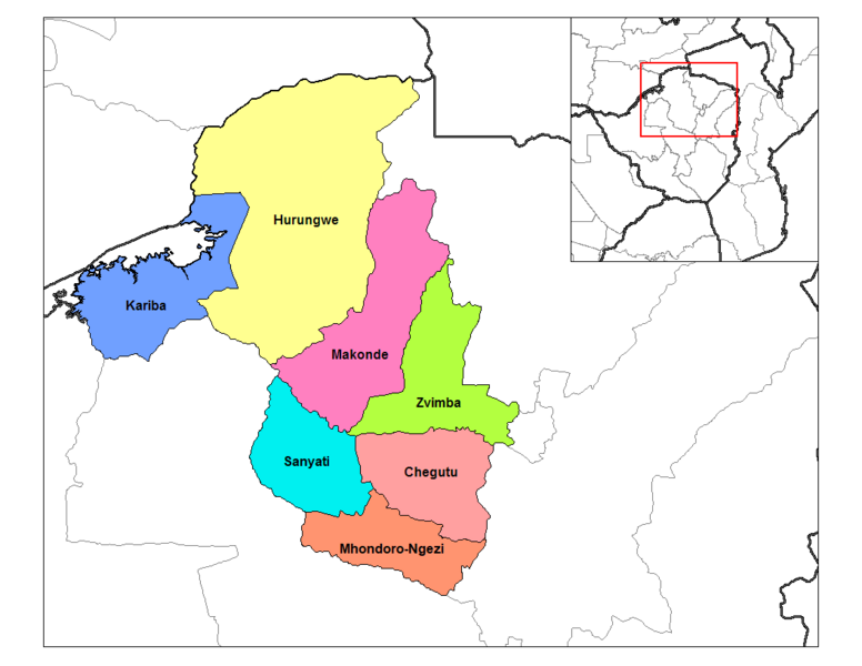
English: Map of the districts of Mashonaland West province of Zimbabwe. |
| 日期 | 2006年9月28日 (原始上传日期) |
| 来源 | 自己的作品 (Rarelibra) using MapInfo Professional v8.5 and various mapping resources. |
| 作者 | 英语维基百科的Rarelibra |
许可协议
| 本作品已被作者英语维基百科的Rarelibra释出到公有领域。这适用于全世界。 在一些国家这可能不合法;如果是这样的话,那么: Rarelibra无条件地授予任何人以任何目的使用本作品的权利,除非这些条件是法律规定所必需的。 |
原始上传日志
原始描述頁面位於這裡。下列使用者名稱均來自en.wikipedia。
- 2006-09-28 18:30 Rarelibra 1056×816× (33143 bytes) Map of the districts of Mashonaland West province of Angola. Created by ~~~~ for public domain use, using MapInfo Professional v8.5 and various mapping resources.
文件历史
点击某个日期/时间查看对应时刻的文件。
| 日期/时间 | 缩略图 | 大小 | 用户 | 备注 | |
|---|---|---|---|---|---|
| 当前 | 2018年8月29日 (三) 15:34 | | 1,056 × 816(41 KB) | Gajmar | Kadoma District split |
| 2011年1月10日 (一) 13:26 |  | 1,056 × 816(32 KB) | Klik9 | {{Information |Description=Map of the districts of Mashonaland West province of Zimbabwe |Source=|Source=Originally from [http://en.wikipedia.org en.wikipedia]; description page is (was) here |Date=2006 |Author |
文件用途
全域文件用途
以下其他wiki使用此文件:
- ca.wikipedia.org上的用途
- de.wikipedia.org上的用途
- en.wikipedia.org上的用途
- es.wikipedia.org上的用途
- frr.wikipedia.org上的用途
- ha.wikipedia.org上的用途
- ig.wikipedia.org上的用途
- it.wikipedia.org上的用途
- ja.wikipedia.org上的用途
- ka.wikipedia.org上的用途
- lt.wikipedia.org上的用途
- mrj.wikipedia.org上的用途
- nl.wikipedia.org上的用途
- pl.wikipedia.org上的用途
- pt.wikipedia.org上的用途
- ru.wikipedia.org上的用途
- si.wikipedia.org上的用途
- sn.wikipedia.org上的用途
- tr.wikipedia.org上的用途
- ts.wikipedia.org上的用途
- uk.wikipedia.org上的用途
- vi.wikipedia.org上的用途
- www.wikidata.org上的用途
- yo.wikipedia.org上的用途
- zu.wikipedia.org上的用途