File:Pacific Theater Areas;map1-zh.svg

此SVG文件的PNG预览的大小:500 × 380像素。 其他分辨率:316 × 240像素 | 632 × 480像素 | 1,011 × 768像素 | 1,280 × 973像素 | 2,560 × 1,946像素。
原始文件 (SVG文件,尺寸为500 × 380像素,文件大小:302 KB)
摘要
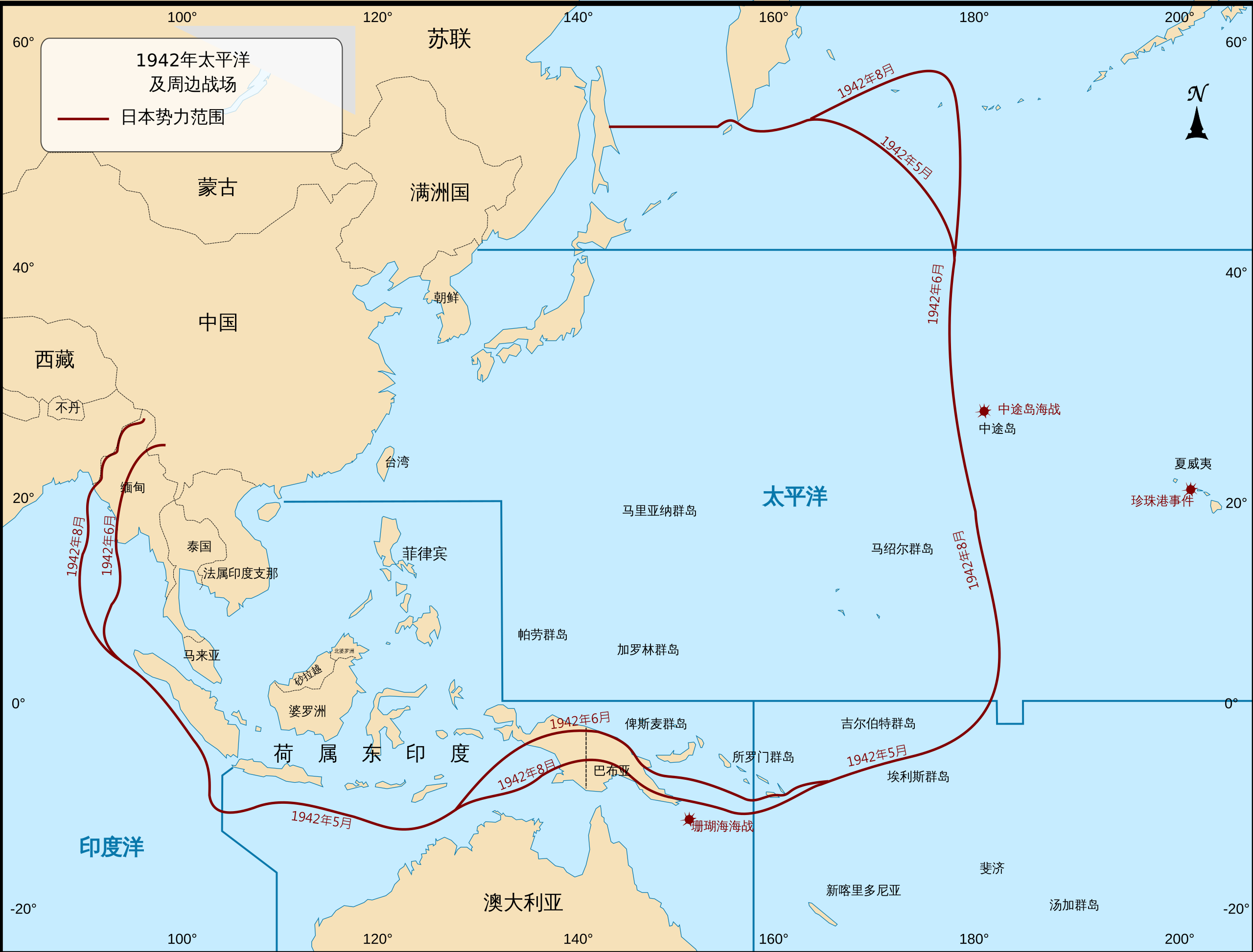
| 描述 | 第二次世界大戰期間太平洋戰場地圖,以及大日本帝國的勢力範圍。 |
| 日期 | (UTC) |
| 来源 |
本檔案衍生自: Pacific Theater Areas;map1.svg: |
| 作者 |
|
| 这是一张修改过的图片,这意味着它已在原版本的基础上通过软件进行了编辑,改动内容:Translated into Chinese。其原始版本为:Pacific Theater Areas;map1.svg。修改者:GnolizX。
|
许可协议
|
|
 |
原始上传日志
This image is a derivative work of the following images:
- File:Pacific Theater Areas;map1.svg licensed with PD-USGov-Military-Army
- 2009-12-01T23:30:45Z Addicted04 500x380 (657165 Bytes) text
- 2009-12-01T23:17:48Z Addicted04 500x380 (263694 Bytes) {{Information |Description=Map of Pacific theater of operations during World War II showing the boundries of the Japanese Empire. |Source=*[[:File:Pacific_Theater_Areas;map1.JPG|]] |Date=2009-12-01 23:15 (UTC) |Author=*[[:Fil
Uploaded with derivativeFX
文件历史
点击某个日期/时间查看对应时刻的文件。
| 日期/时间 | 缩略图 | 大小 | 用户 | 备注 | |
|---|---|---|---|---|---|
| 当前 | 2021年1月29日 (五) 07:15 | | 500 × 380(302 KB) | GnolizX | text to path |
| 2021年1月29日 (五) 07:10 |  | 500 × 380(262 KB) | GnolizX | == {{int:filedesc}} == {{Information |Description=第二次世界大戰期間太平洋戰場地圖,以及大日本帝國的勢力範圍。 |Source={{Derived from|Pacific Theater Areas;map1.svg|display=50}} |Date=2021-01-29 07:10 (UTC) |Author=* File:Pacific Theater Areas;map1.svg: *Pacific_Theater_Areas;map1.JPG: '''Wwoods''' *derivative work: Addicted04 (<span class="signature-talk">talk</span>) * derivative work: [[User:{{... |
文件用途
以下3个页面使用本文件: