File:Ph locator map palawan.png
此为最大尺寸。
Ph_locator_map_palawan.png (300 × 440像素,文件大小:26 KB,MIME类型:image/png)
摘要
| 描述 |
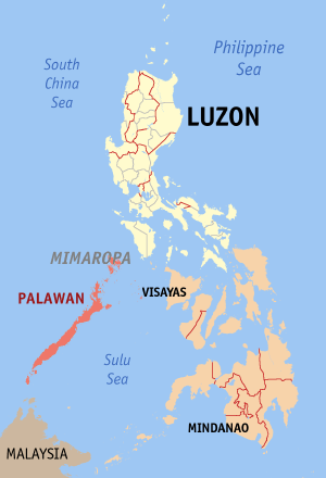
English: Map of the Philippines showing the location of Palawan. Red shade: Palawan Province; Light shade: Luzon Island Group; Orange: Rest of the Philippines |
| 日期 | |
| 来源 | English Wikipedia |
| 作者 | Eugene Alvin Villar (seav) |
许可协议

|
已授权您依据自由软件基金会发行的无固定段落及封面封底文字(Invariant Sections, Front-Cover Texts, and Back-Cover Texts)的GNU自由文件许可协议1.2版或任意后续版本的条款,复制、传播和/或修改本文件。该协议的副本请见“GNU Free Documentation License”。 |
| 本文件采用知识共享署名-相同方式共享 3.0 未本地化版本许可协议授权。 | ||
| ||
| 本许可协议标签作为GFDL许可协议更新的组成部分被添加至本文件。 |

|
If you choose to use this work under the Creative Commons license stated on this page, the author, Eugene Alvin Villar (seav), would like you to attribute the work to him (among other requirements such as indicating that the work is licensed under the Creative Commons) with the following text or similar:
© Eugene Alvin Villar, 2003
His name should be a link to his Wikimedia Commons userpage. If a link is not possible, then the url should be placed in parentheses after the name. If the work has been substantially altered by other people (see the File history section below), then this particular attribution requirement is waived, which means you can attribute the work in any reasonable manner. This attribution requirement is provided pursuant to the Creative Commons Attribution mechanism where "you must attribute the work in the manner specified by the author or licensor (but not in any way that suggests that they endorse you or your use of the work)." (See "Attribution" in the Creative Commons website.)
|
文件历史
点击某个日期/时间查看对应时刻的文件。
| 日期/时间 | 缩略图 | 大小 | 用户 | 备注 | |
|---|---|---|---|---|---|
| 当前 | 2009年7月1日 (三) 13:28 | | 300 × 440(26 KB) | Hariboneagle927 | Palawan is in the MIMAROPA region references: http://en.wikipedia.org/wiki/MIMAROPA |
| 2005年12月30日 (五) 13:53 |  | 300 × 440(19 KB) | Magalhães | Map of the Philippines showing the location of Palawan. Created and copyright (2003) by seav. Released under the GNU FDL. | |
| 2005年8月18日 (四) 20:45 |  | 300 × 450(15 KB) | Gildemax | Map of the Philippines showing the location of Palawan. Map of the Philippines showing the location of Palawan. Created and copyright (2003) by [[:en:user:]seav]]Released under the GNU FDL. Source: http://en.wikipedia.org/wiki/Image:Ph_locator_map_pal |
文件用途
没有页面链接到本图像。
全域文件用途
以下其他wiki使用此文件:
- nl.wikipedia.org上的用途