File:Qarhan Playa.png

本预览的尺寸:800 × 399像素。 其他分辨率:320 × 160像素 | 640 × 319像素 | 1,055 × 526像素。
原始文件 (1,055 × 526像素,文件大小:1.45 MB,MIME类型:image/png)
摘要
| 描述 |
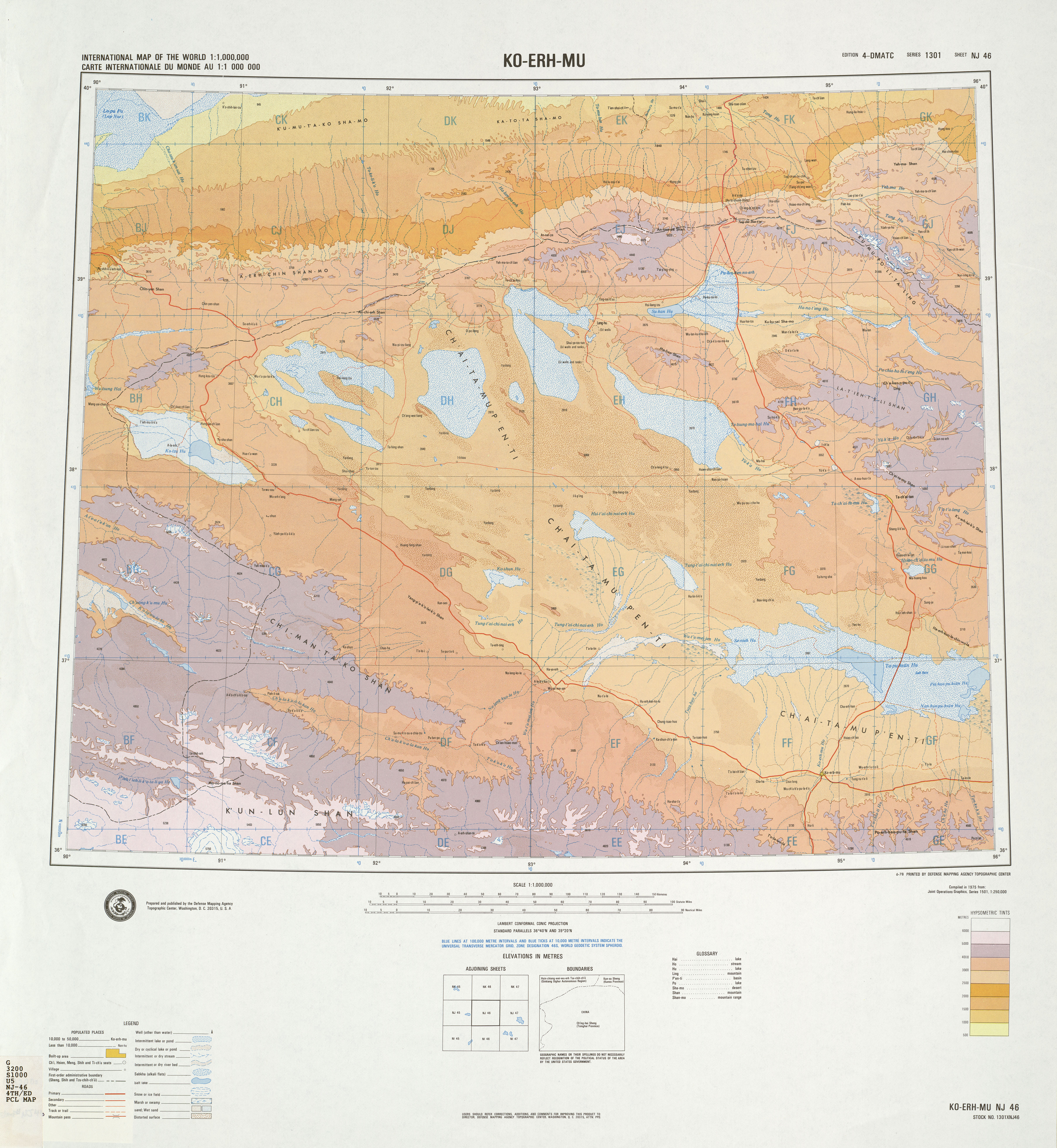
English: A map of the Qarhan Playa in the Qaidam Basin in Qinghai, China. Names given in Chinese using Wade–Giles romanization. Elevation given in meters above sea level. Shown but unnamed: Big & Little Biele Lakes; Donglin Lake; Tuanjie Lake. Not shown: West Dabusun Lake, between Dabusun & the Biele Lakes; Xiezhuo Lake, between Dabusun & North Hulsan Lake. |
| 日期 | |
| 来源 | NJ-46: Ko-erh-mu, hosted at the University of Texas's Perry–Castañeda Library Map Collection |
| 作者 | Topographic Center of the United States Defense Mapping Agency |
| 其他版本 |
|


许可协议
此作品在美国属于公有领域,因为其是由美国政府的官员或雇员,基于其个人公务目的制作的作品,参考美国法典第17篇第1章第105条。
注意︰本模板仅适用于美国联邦政府的原创作品,不适用于任何美国州、属地、联邦个体、县、市或任何次级政府的作品。本模板也不适用于1978年以后由美国邮政署出版的邮票图案(参看美国版权局实践纲领第313.6(C)(1)条)。也不适用于部分美国硬币;参看美国铸币局使用条款。 |
 | |
| 本文件已被确认为免除已知的著作权法限制(包括所有相关权利)。 | ||
| 註解 | 該圖片含有註解:在維基媒體共享資源上查看註解 |
文件历史
点击某个日期/时间查看对应时刻的文件。
| 日期/时间 | 缩略图 | 大小 | 用户 | 备注 | |
|---|---|---|---|---|---|
| 当前 | 2019年8月7日 (三) 06:12 | | 1,055 × 526(1.45 MB) | LlywelynII | User created page with UploadWizard |
文件用途
全域文件用途
以下其他wiki使用此文件:
- en.wikipedia.org上的用途
- pa.wikipedia.org上的用途
- pnb.wikipedia.org上的用途
- te.wikipedia.org上的用途