File:River Gade at Great Gaddesden - geograph.org.uk - 1257620.jpg
此为最大尺寸。
River_Gade_at_Great_Gaddesden_-_geograph.org.uk_-_1257620.jpg (640 × 480像素,文件大小:94 KB,MIME类型:image/jpeg)
摘要
| 描述 |
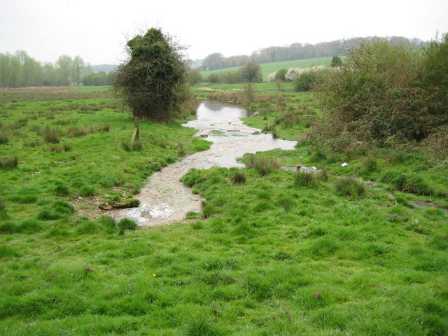
English: River Gade at Great Gaddesden. Taken from the same viewpoint as 140293 and a little over three years later, the water level in the Gade has risen markedly. A spring in the left foreground is vigorously supplying the river with water, while the main channel of the river from 1257651 flows in at the right. Early 20th century Ordnance Survey maps show that there were watercress beds just downstream of this location on the right side of the river. |
| 日期 | |
| 来源 | From geograph.org.uk |
| 作者 | Nigel Cox |
| 署名 (由许可协议要求) | Nigel Cox / River Gade at Great Gaddesden / |
| 相机位置 | | 在以下服务上查看本图像和附近其他图像: OpenStreetMap |
|---|
_heading:157.00&language=zh)
| 物体位置 | | 在以下服务上查看本图像和附近其他图像: OpenStreetMap |
|---|
_heading:157.00&language=zh)
许可协议

|
本文件采用知识共享署名-相同方式共享 2.0 通用许可协议授权。
署名: Nigel Cox
- 您可以自由地:
- 共享 – 复制、发行并传播本作品
- 修改 – 改编作品
- 惟须遵守下列条件:
- 署名 – 您必须对作品进行署名,提供授权条款的链接,并说明是否对原始内容进行了更改。您可以用任何合理的方式来署名,但不得以任何方式表明许可人认可您或您的使用。
- 相同方式共享 – 如果您再混合、转换或者基于本作品进行创作,您必须以与原先许可协议相同或相兼容的许可协议分发您贡献的作品。
文件历史
点击某个日期/时间查看对应时刻的文件。
| 日期/时间 | 缩略图 | 大小 | 用户 | 备注 | |
|---|---|---|---|---|---|
| 当前 | 2011年2月26日 (六) 20:57 | | 640 × 480(94 KB) | GeographBot | == {{int:filedesc}} == {{Information |description={{en|1=River Gade at Great Gaddesden Taken from the same viewpoint as 140293 and a little over three years later, the water level in the Gade has risen markedly. A spring in the left foreground is vigo |
文件用途
以下页面使用本文件:
全域文件用途
以下其他wiki使用此文件:
- en.wikipedia.org上的用途