File:Stadtviertel und Quartiere der Altstadt von Bern.jpg
本预览的尺寸:800 × 367像素。 其他分辨率:320 × 147像素 | 640 × 294像素 | 1,024 × 470像素 | 1,280 × 588像素 | 2,763 × 1,269像素。
原始文件 (2,763 × 1,269像素,文件大小:2.04 MB,MIME类型:image/jpeg)
摘要
| 描述 |
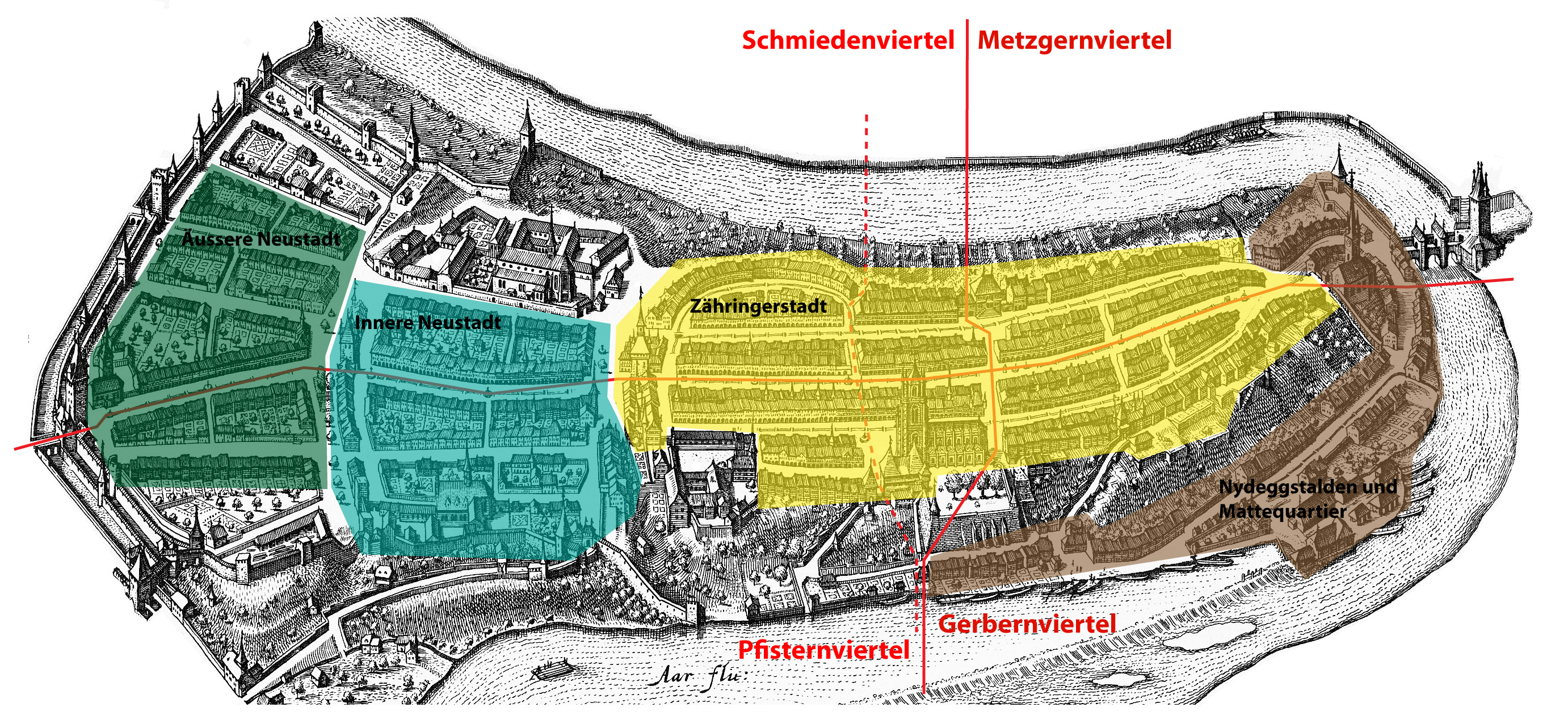
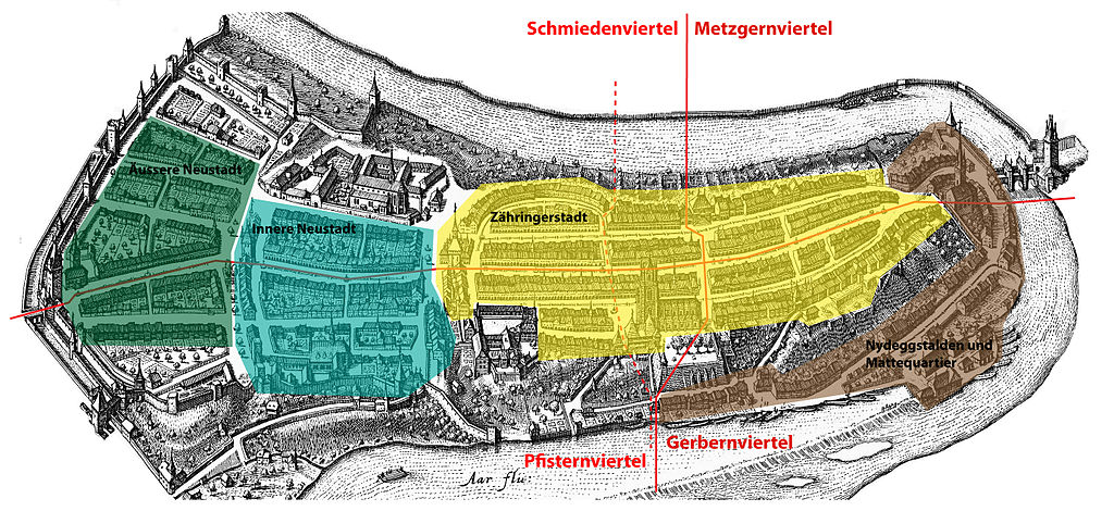
Deutsch: Historische Stadtviertel und Quartiere der Altstadt von Bern. Die punktierte Linie stellt die vom 16. bis zum 18. Jahrhundert geltende neue Viertelgrenze dar. English: Historical districts ("Viertel") and neighbourhoods ("Quartiere") of the old town of Berne. The dotted line represents the new district boundary of the 16th to 18th century. |
| 来源 | Self-made based on Image:MerianBern.jpg and on a map by Roland Gerber in: Ellen J. Beer et al. (eds.), Berns grosse Zeit, ISBN 3-906721-28-0, p. 43. |
| 作者 | Sandstein |
许可协议
| 我,本作品著作权人,释出本作品至公有领域。这适用于全世界。 在一些国家这可能不合法;如果是这样的话,那么: 我无条件地授予任何人以任何目的使用本作品的权利,除非这些条件是法律规定所必需的。 |
文件历史
点击某个日期/时间查看对应时刻的文件。
| 日期/时间 | 缩略图 | 大小 | 用户 | 备注 | |
|---|---|---|---|---|---|
| 当前 | 2008年1月4日 (五) 16:16 | | 2,763 × 1,269(2.04 MB) | Sandstein | {{Information |Description={{de|Historische Stadtviertel und Quartiere der Altstadt von Bern. Die punktierte Linie stellt die vom 16. bis zum 18. Jahrhundert geltende neue Viertelgrenze dar.}}{{en|Historical quarters ("Viertel") and districts ("Quartiere" |
文件用途
全域文件用途
以下其他wiki使用此文件:
- ar.wikipedia.org上的用途
- de.wikipedia.org上的用途
- en.wikipedia.org上的用途
- sl.wikipedia.org上的用途