File:Côte d’Azur overview map.png

預覽大小:800 × 495 像素。 其他解析度:320 × 198 像素 | 640 × 396 像素 | 1,024 × 633 像素 | 1,280 × 791 像素 | 2,560 × 1,583 像素 | 7,377 × 4,561 像素。
原始檔案 (7,377 × 4,561 像素,檔案大小:14.04 MB,MIME 類型:image/png)
摘要
| 拍攝地點 | | 位於此地的本圖片與其他圖片: OpenStreetMap |
|---|
| 描述 |
|
| 日期 | |
| 來源 |
|
| 作者 |
|
| 其他版本 |
 |
授權條款
| This work is licensed under the Open Database License (summary). |
檔案歷史
點選日期/時間以檢視該時間的檔案版本。
| 日期/時間 | 縮圖 | 尺寸 | 使用者 | 備註 | |
|---|---|---|---|---|---|
| 目前 | 2022年5月7日 (六) 10:05 | | 7,377 × 4,561(14.04 MB) | Pechristener | Provinzen angeschrieben |
| 2021年6月12日 (六) 21:26 |  | 7,377 × 4,561(13.94 MB) | Pechristener | einige Korrekturen | |
| 2021年3月18日 (四) 09:14 |  | 3,689 × 2,281(4.78 MB) | Pechristener | grössere Schrift | |
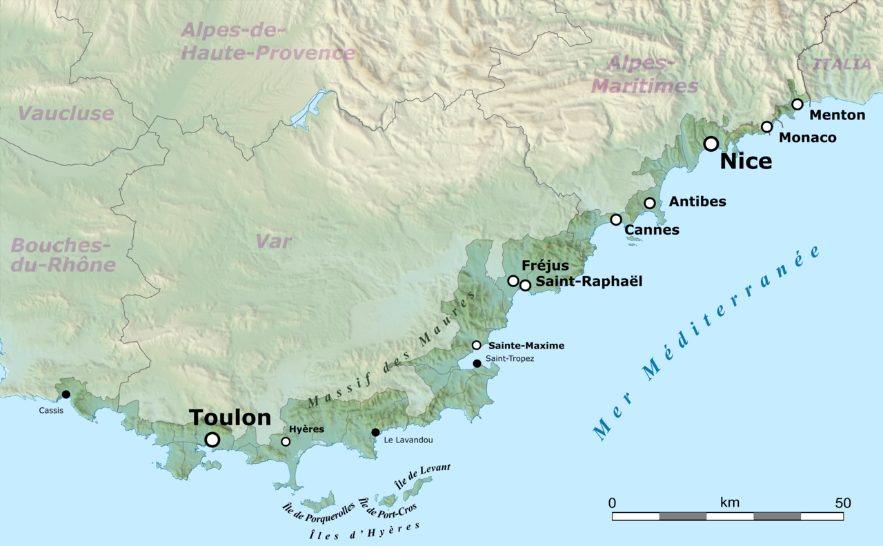
| 2021年3月18日 (四) 08:16 |  | 3,689 × 2,281(4.78 MB) | Pechristener | == {{int:filedesc}} == {{Location|43.449856|6.5415625}} {{Information |Description={{en|Map of French Riviera, France.}} {{fr|Carte de la Côte d'Azur, France.}}<br/> Geographic limits of the map:<br/> *Left: 5.359887<br/> *Right: 7.723238<br/> *Top: 43.979415<br/> *Bottom: 42.920297 |Source= * [http://www.openstreetmap.org Openstreetmap] data * relief: STRM data |Date=2021-03-10 |Author= * OpenStreetMap data: openStree... |
檔案用途
下列頁面有用到此檔案:
全域檔案使用狀況
以下其他 wiki 使用了這個檔案:
- ar.wikipedia.org 的使用狀況
- ast.wikipedia.org 的使用狀況
- ca.wikipedia.org 的使用狀況
- de.wikipedia.org 的使用狀況
- en.wikipedia.org 的使用狀況
- eo.wikipedia.org 的使用狀況
- eu.wikipedia.org 的使用狀況
- fr.wikipedia.org 的使用狀況
- it.wikivoyage.org 的使用狀況
- ja.wikipedia.org 的使用狀況
- ro.wikipedia.org 的使用狀況
- simple.wikipedia.org 的使用狀況
- uk.wikipedia.org 的使用狀況
- www.wikidata.org 的使用狀況