File:Isle of Skye UK location map.svg

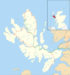
此 SVG 檔案的 PNG 預覽的大小:562 × 600 像素。 其他解析度:225 × 240 像素 | 450 × 480 像素 | 719 × 768 像素 | 959 × 1,024 像素 | 1,919 × 2,048 像素 | 1,334 × 1,424 像素。
原始檔案 (SVG 檔案,表面大小:1,334 × 1,424 像素,檔案大小:1.56 MB)
| 描述 |
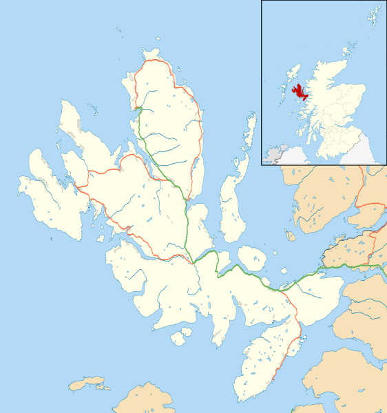
Blank map of the Isle of Skye, UK, as well as the adjacent islands, with the following information shown:
Equirectangular map projection on WGS 84 datum, with N/S stretched 180% Geographic limits:
|
| 日期 | |
| 來源 |
|
| 作者 | Nilfanion, created using Ordnance Survey data |
| 授權許可 (重用此檔案) |
此檔案採用創用CC 姓名標示-相同方式分享 3.0 未在地化版本授權條款。 姓名標示: Contains Ordnance Survey data © Crown copyright and database right
|
| 其他版本 | File:Isle of Skye UK blank map.svg - Blank map |
檔案歷史
點選日期/時間以檢視該時間的檔案版本。
| 日期/時間 | 縮圖 | 尺寸 | 使用者 | 備註 | |
|---|---|---|---|---|---|
| 目前 | 2011年2月4日 (五) 11:20 | | 1,334 × 1,424(1.56 MB) | Nilfanion | {{Information |Description=Blank map of the Isle of Skye, UK, as well as the adjacent islands, with the following information shown: *Coastline, lakes and rivers *Roads and railways *Urban areas Equirectangular map projection on WGS 84 |
檔案用途
全域檔案使用狀況
以下其他 wiki 使用了這個檔案:
- ar.wikipedia.org 的使用狀況
- ceb.wikipedia.org 的使用狀況
- de.wikipedia.org 的使用狀況
- en.wikipedia.org 的使用狀況
- Portree
- Armadale, Skye
- Dunvegan Castle
- Dunvegan
- Edinbane
- Ullinish
- Kyleakin
- Uig, Snizort
- Duntulm
- Struan, Skye
- Aird of Sleat
- Kylerhea
- Sligachan
- Broadford, Skye
- Isleornsay
- Tarskavaig
- Colbost
- Torrin
- Ose, Skye
- Upper Breakish
- Achachork
- Camasunary
- Boreraig
- Ardvasar
- Bornesketaig
- Borreraig
- Borrodale
- Ashaig
- Bracadale
- Kilmuir, Skye
- Mackinnon Memorial Hospital
- Uigshader
- Borve, Skye
- Trumpan
- Gillen, Skye
- Dun Ringill
- Kilmarie
- Heaste
- Lower Breakish
- Portnalong
- Camastianavaig
- Elgol
- Brogaig
- Bernisdale
- Idrigill
- Luib, Skye
- Lealt, Skye
檢視此檔案的更多全域使用狀況。