File:HRE and Byzantine Empire.png
預覽大小:800 × 584 像素。 其他解析度:320 × 234 像素 | 640 × 468 像素 | 1,024 × 748 像素 | 1,280 × 935 像素 | 2,560 × 1,870 像素 | 3,745 × 2,736 像素。
原始檔案 (3,745 × 2,736 像素,檔案大小:708 KB,MIME 類型:image/png)
摘要
| 描述 |
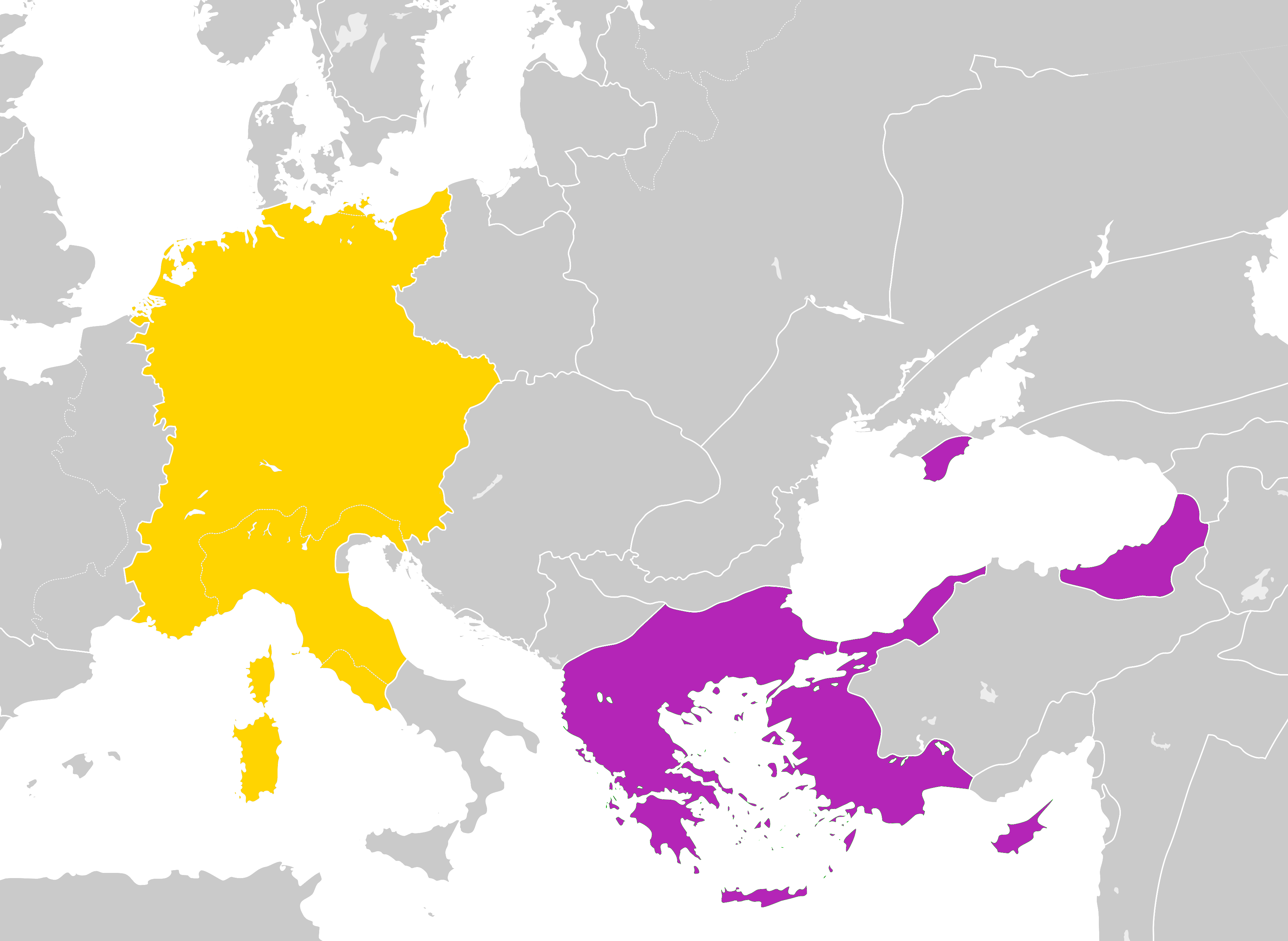
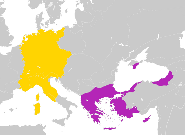
English: Map of the Byzantine Empire and the Holy Roman Empire in 1190 AD. |
| 日期 | |
| 來源 | Byzantine Empire 1190.svg |
| 作者 |
User:Alphathon User:Ichthyovenator (derivative work) |
授權條款
此檔案採用共享創意 姓名標示-相同方式分享 4.0 國際授權條款。
- 您可以自由:
- 分享 – 複製、發佈和傳播本作品
- 重新修改 – 創作演繹作品
- 惟需遵照下列條件:
- 姓名標示 – 您必須指名出正確的製作者,和提供授權條款的連結,以及表示是否有對內容上做出變更。您可以用任何合理的方式來行動,但不得以任何方式表明授權條款是對您許可或是由您所使用。
- 相同方式分享 – 如果您利用本素材進行再混合、轉換或創作,您必須基於如同原先的相同或兼容的條款,來分布您的貢獻成品。
檔案歷史
點選日期/時間以檢視該時間的檔案版本。
| 日期/時間 | 縮圖 | 尺寸 | 用戶 | 備註 | |
|---|---|---|---|---|---|
| 目前 | 2021年9月27日 (一) 04:36 | | 3,745 × 2,736(708 KB) | GPinkerton | Reverted to version as of 12:22, 30 December 2019 (UTC) COM:CROP |
| 2020年6月18日 (四) 15:25 |  | 3,745 × 2,736(584 KB) | Claude Zygiel | Church states were autonomous; removed modern dam reservoirs and the horizontal line through the Cuman Khanate; Second Bulgarian Empire included the vlach territories on the northern bank of the lower Danube; Scythia minor on the southern bank of the lower Danube were byzantine (Paristrion). Following Hans-Erich Stier (dir.), ''Grosser Atlas zur Weltgeschichte'', Westermann, Braunschweig 1985, (ISBN 3-14-100919-8). | |
| 2019年12月30日 (一) 12:22 |  | 3,745 × 2,736(708 KB) | Ichthyovenator | User created page with UploadWizard |
檔案用途
下列頁面有用到此檔案:
全域檔案使用狀況
以下其他 wiki 使用了這個檔案:
- en.wikipedia.org 的使用狀況
- en.wiktionary.org 的使用狀況
- it.wikipedia.org 的使用狀況
- ko.wikipedia.org 的使用狀況
- pl.wikipedia.org 的使用狀況
- th.wikipedia.org 的使用狀況