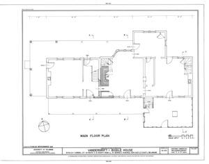
File:Vandergrift-Biddle House, Junction of US Route 13 and County Road 2, Saint Georges Hundred, Biddles Corner, New Castle County, DE HABS DEL,2-BIDCO,1- (sheet 1 of 8).png

原始檔案(9,658 × 7,584 像素,檔案大小:3.59 MB,MIME 類型:image/png


This image is a JPEG version of the original TIF image at File: Vandergrift-Biddle House, Junction of US Route 13 and County Road 2, Saint Georges Hundred, Biddles Corner, New Castle County, DE HABS DEL,2-BIDCO,1- (sheet 1 of 8).tif.

However, any edits to the image should be based on the original TIF version in order to prevent generation loss, and both versions should be updated. Do not make edits based on this version.

摘要

HABS DEL,2-BIDCO,1- (sheet 1 of 8) - Vandergrift-Biddle House, Junction of US Route 13 and County Road 2, Saint Georges Hundred, Biddles Corner, New Castle County, DE
標題
HABS DEL,2-BIDCO,1- (sheet 1 of 8) - Vandergrift-Biddle House, Junction of US Route 13 and County Road 2, Saint Georges Hundred, Biddles Corner, New Castle County, DE
描繪地點 Delaware; New Castle County; Biddles Corner
日期 Documentation compiled after 1933
尺寸 19 x 24 in. (B size)
目前所在位置
Library of Congress Prints and Photographs Division Washington, D.C. 20540 USA http://hdl.loc.gov/loc.pnp/pp.print
登錄號
HABS DEL,2-BIDCO,1- (sheet 1 of 8)
取得方式/備註
This file comes from the Historic American Buildings Survey (HABS), Historic American Engineering Record (HAER) or Historic American Landscapes Survey (HALS). These are programs of the National Park Service established for the purpose of documenting historic places. Records consist of measured drawings, archival photographs, and written reports.

此標籤不表示文件的著作權狀態。任何文件在附有此標籤的同時還需要一個有效的著作權標籤請參閱許可協議說明頁面以了解更多資訊。

備註
  • Significance: Begun by the Vandergrift family in the mid-eighteenth century as a one-story, hall-plan dwelling and repeatedly enlarged through the nineteenth century by the Biddle family and others, the Vandergrift-Biddle House is significant for the changes in house form and timber-building technology in its long and complicated history. With its seven major building periods, using a variety of construction techniques including joined plank, braced frame (mortise and tenoned post and beam), and balloon frame, the Vandergrift-Biddle House has achieved both architectural significance and integrity by the process of historic accretion. For instance, the sequence of alterations in the hall hearth clearly demonstrates changing social attitudes toward cleanliness and comfort; the firebox was closed down repeatedly to provide ever more heat, while at the same time, further containing dirt and smoke. Successive generations of the Vandergrift and Biddle families also incorporated modern concepts in the plan, but never strayed from traditional patterns of architectural logic. In each period of its growth the house was rebuilt as a new and larger structure; increasingly unified on the exterior, but retaining much of its earlier fabric. The Vandergrift-Biddle House was listed on the National Register of Historic Places in December, 1978.
  • Unprocessed Field note material exists for this structure: FN-45
  • Survey number: HABS DE-224
  • Building/structure dates: ca. 1750 Initial Construction
  • Building/structure dates: ca. 1800 Subsequent Work
  • Building/structure dates: ca. 1830 Subsequent Work
  • Building/structure dates: ca. 1840 Subsequent Work
  • Building/structure dates: ca. 1870 Subsequent Work
  • Building/structure dates: ca. 1890 Subsequent Work
參考文獻

此圖片所涉及之地點或建築現被列入美國的國家史蹟名錄。其登錄號為 78000908.

來源 https://www.loc.gov/pictures/item/de0322.sheet.00001a
授權許可
(重用此檔案)
Public domain This image or media file contains material based on a work of a National Park Service employee, created as part of that person's official duties. As a work of the U.S. federal government, such work is in the public domain in the United States. See the NPS website and NPS copyright policy for more information.
其他版本
拍攝地點39° 31′ 30″ 北, 75° 38′ 57.98″ 西 Kartographer map based on OpenStreetMap.位於此地的本圖片與其他圖片: OpenStreetMapinfo

說明

添加單行說明來描述出檔案所代表的內容

在此檔案描寫的項目

描繪內容

Biddle House 英文

著作權狀態 繁體中文 (已轉換拼寫)

製作地點 中文 (已轉換拼寫)

視角坐標 繁體中文 (已轉換拼寫)

39°31'30"N, 75°38'56"W

檔案歷史

點選日期/時間以檢視該時間的檔案版本。

日期/時間縮⁠圖尺寸用戶備⁠註
目前2014年7月20日 (日) 19:00於 2014年7月20日 (日) 19:00 版本的縮圖9,658 × 7,584(3.59 MB){{Compressed version|file=File:Vandergrift-Biddle_House,_Junction_of_US_Route_13_and_County_Road_2,_Saint_Georges_Hundred,_Biddles_Corner,_New_Castle_County,_DE_HABS_DEL,2-BIDCO,1-_(sheet_1_of_8).tif|thumb=nothumb}} =={{int:filedesc}}== {{Photograph...

下列頁面有用到此檔案:

全域檔案使用狀況

以下其他 wiki 使用了這個檔案:

詮釋資料