File:Satsunan-Islands-Kagoshima-Japan.png

預覽大小:391 × 599 像素。 其他解析度:157 × 240 像素 | 313 × 480 像素 | 501 × 768 像素 | 668 × 1,024 像素 | 1,622 × 2,484 像素。
原始檔案 (1,622 × 2,484 像素,檔案大小:1.24 MB,MIME 類型:image/png)
摘要
| 描述 |
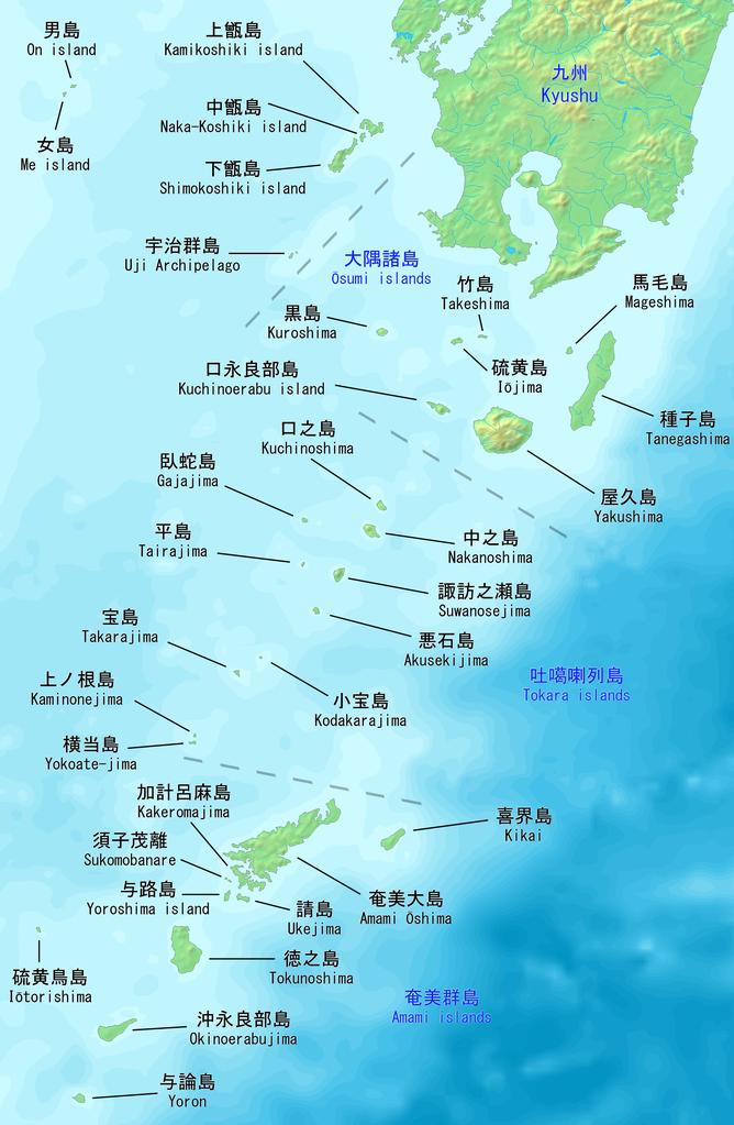
English: Map of the Satsunan Islands of Kagoshima, Japan. Made with DEMIS World Map Server.
日本語: 薩南諸島の地図。 鹿児島、日本。 |
||||
| 日期 | |||||
| 來源 | https://www.demis.nl/products/web-map-server/examples | ||||
| 作者 |
DEMIS World Map Server, Artanisen
|
授權條款
| 此檔案在創用CC CC0 1.0 通用公有領域貢獻宣告之下分發。 | |
| 在此宣告之下分發本作品者,已依據各國著作權法,在全世界放棄其對本作品所擁有的著作權及所有相關相似的法律權利,從而將本作品貢獻至公有領域。您可以複製、修改、分發和演示該作品,用於任何商業用途,所有這些都不需要請求授權。
|
檔案歷史
點選日期/時間以檢視該時間的檔案版本。
| 日期/時間 | 縮圖 | 尺寸 | 用戶 | 備註 | |
|---|---|---|---|---|---|
| 目前 | 2019年10月22日 (二) 20:04 | | 1,622 × 2,484(1.24 MB) | Artanisen | Added Sukomobanare island (須子茂離島). |
| 2019年10月21日 (一) 05:09 |  | 1,622 × 2,484(1.22 MB) | Artanisen | Added info about the Tokara islands, Amami islands and Osumi islands. | |
| 2019年10月20日 (日) 20:23 |  | 1,622 × 2,484(1.15 MB) | Artanisen | User created page with UploadWizard |
檔案用途
全域檔案使用狀況
以下其他 wiki 使用了這個檔案:
- ar.wikipedia.org 的使用狀況
- az.wikipedia.org 的使用狀況
- bg.wikipedia.org 的使用狀況
- bn.wikipedia.org 的使用狀況
- ca.wikipedia.org 的使用狀況
- ceb.wikipedia.org 的使用狀況
- cs.wikipedia.org 的使用狀況
- de.wikipedia.org 的使用狀況
- en.wikipedia.org 的使用狀況
- es.wikipedia.org 的使用狀況
- fa.wikipedia.org 的使用狀況
- fr.wikipedia.org 的使用狀況
- gl.wikipedia.org 的使用狀況
- id.wikipedia.org 的使用狀況
- it.wikipedia.org 的使用狀況
- ja.wikipedia.org 的使用狀況
檢視此檔案的更多全域使用狀況。