File:Sierra Nevada map.png
此為最大尺寸。
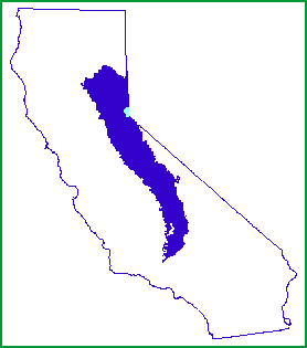
Sierra_Nevada_map.png (278 × 315 像素,檔案大小:5 KB,MIME 類型:image/png)

|
File:Sierra Nevada map vector.svg是本檔案的向量版本。 如果品質不低,就應該優先使用該檔案,而非PNG檔案。
File:Sierra Nevada map.png → File:Sierra Nevada map vector.svg
更多資訊請參閱Help:SVG/zh。 |
 |
摘要
| 描述 | |
| 日期 | |
| 來源 | http://www.fs.fed.us/r5/spf/publications/fh_94-95/m261e.htm |
| 作者 | John W. Dale, U.S. Forest Service |
| 授權許可 (重用此檔案) |
Public Domain |
授權條款
This image is a work of the Forest Service of the United States Department of Agriculture. As a work of the U.S. federal government, the image is in the public domain.
|
檔案歷史
點選日期/時間以檢視該時間的檔案版本。
| 日期/時間 | 縮圖 | 尺寸 | 用戶 | 備註 | |
|---|---|---|---|---|---|
| 目前 | 2007年1月7日 (日) 23:21 | | 278 × 315(5 KB) | Hike395 | {{Information |Description=Map of the Sierra Nevada, United States |Source=http://www.fs.fed.us/r5/spf/publications/fh_94-95/m261e.htm |Date=1999-07-12 |Author=John W. Dale, U.S. Forest Service |Permission=Public Domain }} |
檔案用途
下列2個頁面有用到此檔案:
全域檔案使用狀況
以下其他 wiki 使用了這個檔案:
- af.wikipedia.org 的使用狀況
- cs.wikipedia.org 的使用狀況
- cy.wikipedia.org 的使用狀況
- de.wikipedia.org 的使用狀況
- en.wikipedia.org 的使用狀況
- eo.wikipedia.org 的使用狀況
- fi.wiktionary.org 的使用狀況
- frr.wikipedia.org 的使用狀況
- fy.wikipedia.org 的使用狀況
- gd.wikipedia.org 的使用狀況
- gl.wikipedia.org 的使用狀況
- he.wikipedia.org 的使用狀況
- hr.wikipedia.org 的使用狀況
- id.wikipedia.org 的使用狀況
- ja.wikipedia.org 的使用狀況
- ko.wikipedia.org 的使用狀況
- ml.wikipedia.org 的使用狀況
- mr.wikipedia.org 的使用狀況
- nn.wikipedia.org 的使用狀況
- no.wikipedia.org 的使用狀況
- pnb.wikipedia.org 的使用狀況
- pt.wikipedia.org 的使用狀況
- sco.wikipedia.org 的使用狀況
- sh.wikipedia.org 的使用狀況
- simple.wikipedia.org 的使用狀況
- sk.wikipedia.org 的使用狀況
- sl.wikipedia.org 的使用狀況
- sr.wikipedia.org 的使用狀況
- sv.wikipedia.org 的使用狀況
- ta.wikipedia.org 的使用狀況
- tr.wikipedia.org 的使用狀況
- uk.wikipedia.org 的使用狀況
- vi.wikipedia.org 的使用狀況