File:Brooks Range-400px.jpg
此為最大尺寸。
Brooks_Range-400px.jpg (400 × 266 像素,檔案大小:50 KB,MIME 類型:image/jpeg)
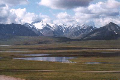
PD photo of Brooks Range near Galbraith Lake, collected from http://wwwndo.ak.blm.gov/arcticinfo/tours/brooks-4.htm archive copy at the Wayback Machine (BLM Northern Field Office) and cropped.
| This image is a work of a Bureau of Land Management* employee, taken or made as part of that person's official duties. As a work of the U.S. federal government, the image is in the public domain in the United States. *or predecessor organization |
檔案歷史
點選日期/時間以檢視該時間的檔案版本。
| 日期/時間 | 縮圖 | 尺寸 | 使用者 | 備註 | |
|---|---|---|---|---|---|
| 目前 | 2006年9月21日 (四) 02:59 | | 400 × 266(50 KB) | Góngora | PD photo of Brooks Range near Galbraith Lake, collected from http://wwwndo.ak.blm.gov/arcticinfo/tours/brooks-4.htm (BLM Northern Field Office) and cropped. {{PD-USGov-Interior-BLM}} |
檔案用途
下列頁面有用到此檔案:
全域檔案使用狀況
以下其他 wiki 使用了這個檔案:
- ca.wikipedia.org 的使用狀況
- cs.wikipedia.org 的使用狀況
- de.wikipedia.org 的使用狀況
- en.wikipedia.org 的使用狀況
- eo.wikipedia.org 的使用狀況
- es.wikipedia.org 的使用狀況
- fa.wikipedia.org 的使用狀況
- fr.wikipedia.org 的使用狀況
- fy.wikipedia.org 的使用狀況
- ka.wikipedia.org 的使用狀況
- lt.wikipedia.org 的使用狀況
- ml.wikipedia.org 的使用狀況
- nl.wikipedia.org 的使用狀況
- no.wikipedia.org 的使用狀況
- ru.wikipedia.org 的使用狀況
- simple.wikipedia.org 的使用狀況
- sl.wikipedia.org 的使用狀況
- tr.wikipedia.org 的使用狀況
- uz.wikipedia.org 的使用狀況
- vec.wikipedia.org 的使用狀況