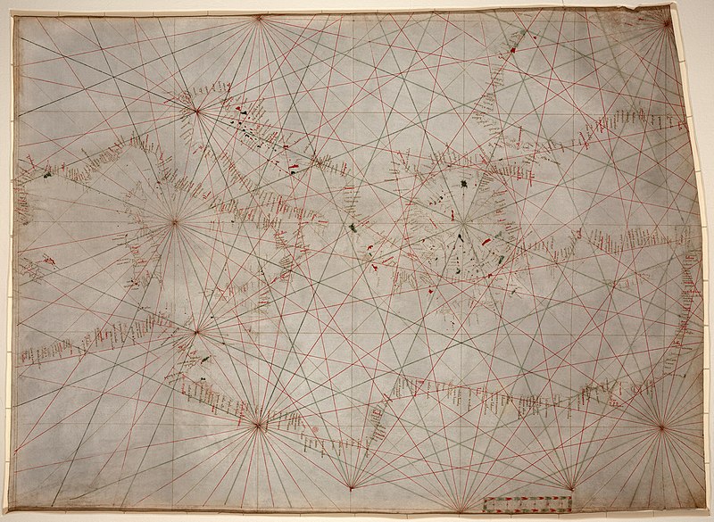
File:Mediterranean chart fourteenth century2.jpg

預覽大小:800 × 585 像素。 其他解析度:320 × 234 像素 | 640 × 468 像素 | 1,024 × 748 像素 | 1,280 × 935 像素 | 2,560 × 1,871 像素 | 5,486 × 4,009 像素。
原始檔案 (5,486 × 4,009 像素,檔案大小:17.24 MB,MIME 類型:image/jpeg)
檔案歷史
點選日期/時間以檢視該時間的檔案版本。
| 日期/時間 | 縮圖 | 尺寸 | 使用者 | 備註 | |
|---|---|---|---|---|---|
| 目前 | 2009年1月18日 (日) 02:53 |  | 5,486 × 4,009(17.24 MB) | Durova | {{Information |Description=Anonymous nautical chart in portolan style probably drawn in Genoa. Covers Mediterranean Sea from the Balearic Islands to the Levantine coast; also covers western part of Black Sea. Oldest original cartographic artifact in t |
檔案用途
下列頁面有用到此檔案:
全域檔案使用狀況
以下其他 wiki 使用了這個檔案:
- ar.wikipedia.org 的使用狀況
- ca.wikipedia.org 的使用狀況
- en.wikipedia.org 的使用狀況
- Portolan chart
- Wikipedia:Featured pictures/Diagrams, drawings, and maps/Maps
- Wikipedia:Featured pictures thumbs/15
- Wikipedia:Featured picture candidates/January-2009
- Wikipedia:Featured picture candidates/Portolan chart of the Mediterranean
- Wikipedia:Wikipedia Signpost/2009-01-31/Features and admins
- User talk:Durova/Archive 65
- Wikipedia:Picture of the day/October 2009
- User:Durova/Featured credits at the Turkish language Wikipedia
- Template:POTD/2009-10-22
- User talk:Durova/Archive 73
- User:Durova/Featured picture gallery/2009
- User:Walrasiad/Maps
- Rule of marteloio
- Wikipedia:Wikipedia Signpost/2009-01-31/SPV
- Wikipedia:Wikipedia Signpost/Single/2009-01-31
- es.wikipedia.org 的使用狀況
- et.wikipedia.org 的使用狀況
- eu.wikipedia.org 的使用狀況
- gl.wikipedia.org 的使用狀況
- he.wikipedia.org 的使用狀況
- hr.wikipedia.org 的使用狀況
- incubator.wikimedia.org 的使用狀況
- it.wikipedia.org 的使用狀況
- ja.wikipedia.org 的使用狀況
- ko.wikipedia.org 的使用狀況
- mn.wikipedia.org 的使用狀況
- ms.wikipedia.org 的使用狀況
- pl.wikipedia.org 的使用狀況
- ps.wikipedia.org 的使用狀況
- pt.wikipedia.org 的使用狀況
- sh.wikipedia.org 的使用狀況
- si.wikipedia.org 的使用狀況
- sl.wikipedia.org 的使用狀況
- sr.wikipedia.org 的使用狀況
- ta.wikipedia.org 的使用狀況
- th.wikipedia.org 的使用狀況
- tr.wikipedia.org 的使用狀況
檢視此檔案的更多全域使用狀況。
