File:Sverigekarta-Landsdelar, namn och landskap.svg

此 SVG 檔案的 PNG 預覽的大小:263 × 599 像素。 其他解析度:105 × 240 像素 | 211 × 480 像素 | 337 × 768 像素 | 450 × 1,024 像素 | 900 × 2,048 像素 | 290 × 660 像素。
原始檔案 (SVG 檔案,表面大小:290 × 660 像素,檔案大小:381 KB)
| 描述 |
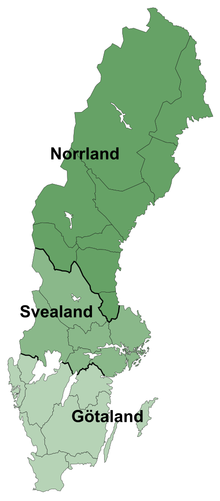
English: Map showing the three lands of Sweden: Norrland, Svealand and Götaland.
Svenska: Karta över Sveriges landsdelar: Norrland, Svealand och Götaland. |
| 日期 | uploaded February 8, 2009 |
| 來源 | Based on Sverigekarta-Landskap.svg by Lapplänning which was based on SWE-Map Kommuner2007.svg by Lokal_Profil |
| 作者 | Lapplänning |
| 授權許可 (重用此檔案) |
此檔案採用創用CC 姓名標示-相同方式分享 2.5 通用版授權條款。
|
| 其他版本 |
|


檔案歷史
點選日期/時間以檢視該時間的檔案版本。
| 日期/時間 | 縮圖 | 尺寸 | 使用者 | 備註 | |
|---|---|---|---|---|---|
| 目前 | 2009年2月8日 (日) 16:48 | | 290 × 660(381 KB) | Lapplänning | trying once more |
| 2009年2月8日 (日) 15:39 |  | 290 × 660(112 KB) | Lapplänning | last try | |
| 2009年2月8日 (日) 15:26 |  | 290 × 660(108 KB) | Lapplänning | ... and again | |
| 2009年2月8日 (日) 15:23 |  | 290 × 660(108 KB) | Lapplänning | trying again | |
| 2009年2月8日 (日) 15:07 |  | 290 × 660(110 KB) | Lapplänning | trying to fix fileproblem | |
| 2009年2月8日 (日) 15:05 |  | 290 × 660(110 KB) | Lapplänning | {{Information |Description={{en|1=Map showing the three en:lands of Sweden: Norrland, Svealand and Götaland.}} {{sv|1=Karta över sv:Sveriges landsdelar: Norrland, Svealand och Götaland.}} |Source=Based on [[:file:Sverigekarta-Landskap.svg|] |
檔案用途
下列頁面有用到此檔案:
全域檔案使用狀況
以下其他 wiki 使用了這個檔案:
- be.wikipedia.org 的使用狀況
- br.wikipedia.org 的使用狀況
- da.wikipedia.org 的使用狀況
- de.wikipedia.org 的使用狀況
- el.wikipedia.org 的使用狀況
- en.wikipedia.org 的使用狀況
- fa.wikipedia.org 的使用狀況
- fi.wikipedia.org 的使用狀況
- fr.wikipedia.org 的使用狀況
- fy.wikipedia.org 的使用狀況
- gl.wikipedia.org 的使用狀況
- id.wikipedia.org 的使用狀況
- it.wikipedia.org 的使用狀況
- ja.wikipedia.org 的使用狀況
- ka.wikipedia.org 的使用狀況
- ko.wikipedia.org 的使用狀況
- ku.wikipedia.org 的使用狀況
- lt.wikipedia.org 的使用狀況
- nl.wikipedia.org 的使用狀況
- no.wikipedia.org 的使用狀況
- pt.wikipedia.org 的使用狀況
- ro.wikipedia.org 的使用狀況
- ru.wikipedia.org 的使用狀況
- sq.wikipedia.org 的使用狀況
- sv.wikipedia.org 的使用狀況
- tr.wikipedia.org 的使用狀況
- uk.wikipedia.org 的使用狀況