薩康泰山
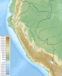
薩康泰山(西班牙語:Salcantay;奇楚瓦語:Sallqantay),是秘魯的山峰,位於該國東南部庫斯科大區,處於庫斯科西北面約60公里,屬於安第斯山脈中維爾卡潘帕山脈的一部分,海拔高度6,271米,人類在1952年8月4日首次登頂。
| 薩康泰山 | |
|---|---|
 薩康泰山西南面山容 | |
| 最高点 | |
| 海拔 | 6,271米(20,574英尺) [1][2][3][4]或6,264米(20,551英尺)[5][6] |
| 地形突起度 | 2,540米(8,330英尺) [5][6] |
| 列表 | 极端突出类山峰 |
| 坐标 | 13°20′01″S 72°32′40″W / 13.33361°S 72.54444°W坐标:13°20′01″S 72°32′40″W / 13.33361°S 72.54444°W |
| 地理 | |
| 位置 | |
| 山脈 | 安地斯山脈之維爾卡潘帕山脈[3][4][6][7][8] |
| 攀山 | |
| 首次登頂 | Fred D. Ayres、David Michael Jr.、W. V. Graham Matthews、George Irving Bell、Claude Kogan、Bernard Pierre(1952年8月4日) |
| 最简路线 | 東北稜:技術攀登(冰攀、雪攀) 法國難度系統:AD(頗難)[4] |
參考資料 编辑
- ^ This elevation is from a Peruvian military survey, quoted in the American Alpine Journal, 1973
- ^ INEI, Perú: Compendio Estadístico 2005, op. cit.
- ^ 3.0 3.1 Encarta/Spanish, "Cordillera Vilcabamba" and "Salcantay", op. cit.
- ^ 4.0 4.1 4.2 Biggar 2005, op. cit.
- ^ 5.0 5.1 Ferranti 2005, "Peru ultra-Prominences", op. cit.
- ^ 6.0 6.1 6.2 Peakbagger, "Salcantay, Peru", op. cit.
- ^ INEI, Perú: Compendio Estadístico 2005, op. cit., attaches three peaks including the Salcantay to the Cordillera Vilcanota instead of Vilcabamba, but this was identified as a typo, and all other sources disagreed. Details in the endnotes to article "List of mountains in Peru".
- ^ Rachowiecki 1991, op. cit.
| 这是一篇與秘魯地理相關的小作品。你可以通过编辑或修订扩充其内容。 |
