File:1928 Okeechobee Flood.png
本预览的尺寸:626 × 600像素。 其他分辨率:251 × 240像素 | 501 × 480像素 | 855 × 819像素。
原始文件 (855 × 819像素,文件大小:172 KB,MIME类型:image/png)
摘要
| 描述 |
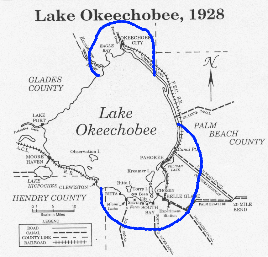
English: Map showing the area of the flood caused by the 1928 Okeechobee hurricane. Ironically, residents of Torry Island, on the south side of the lake, owe their survival to the resulting flood. Note: The Palm Beach County label is misplaced. North of Canal Point has been in Martin County since 1925. |
| 日期 | |
| 来源 | From http://www.srh.noaa.gov/mfl/newpage/Okeechobee.htm. |
| 作者 | NOAA |
许可协议
本图像属于公有领域,因该作品最初来自于美国国家海洋和大气管理局职员的职务作品。
|

|
此old map图片可使用矢量图形重新创建为SVG文件。这具有很多好处;更多信息请参见共享资源:待清理媒体。如果存在此图片的SVG格式,请将其上传,然后将此模板替换为
{{vector version available|新图片名称}}。
建议您将SVG命名为“1928 Okeechobee Flood.svg”,这样在使用Vector version available(或Vva)模板时就不需要填写新图片名称参数。 |
文件历史
点击某个日期/时间查看对应时刻的文件。
| 日期/时间 | 缩略图 | 大小 | 用户 | 备注 | |
|---|---|---|---|---|---|
| 当前 | 2005年10月7日 (五) 08:33 | | 855 × 819(172 KB) | Jdorje~commonswiki | Map showing the area of the flood caused by the 1928 Okeechobee hurricane. From [http://www.srh.noaa.gov/mfl/newpage/Okeechobee.htm]. |
文件用途
以下页面使用本文件:
全域文件用途
以下其他wiki使用此文件:
- de.wikipedia.org上的用途
- en.wikipedia.org上的用途
- fr.wikipedia.org上的用途
- ja.wikipedia.org上的用途
- pl.wikipedia.org上的用途