File:1945-02-15GerWW2BattlefrontAtlas.jpg
本预览的尺寸:616 × 600像素。 其他分辨率:247 × 240像素 | 493 × 480像素 | 789 × 768像素 | 1,250 × 1,217像素。
原始文件 (1,250 × 1,217像素,文件大小:1.26 MB,MIME类型:image/jpeg)

|
本文件已被1945-02-15GerWW2BattlefrontAtlas reworked.jpg取代。建议您使用其他文件。请注意,删除被取代的图片需要达成一致。
|

|
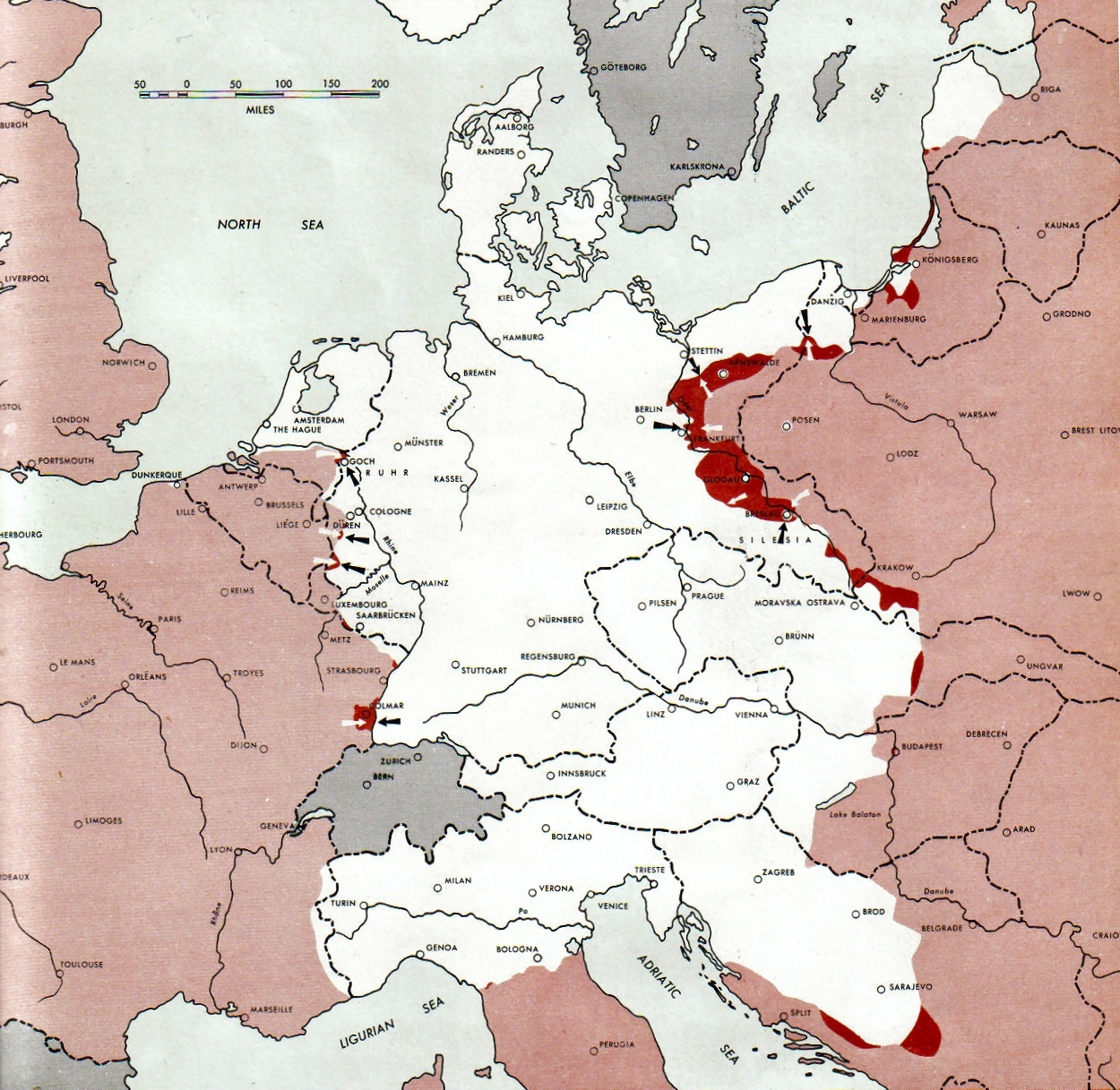
Atlas of the World Battle Fronts - War against Germany: 1945-02-15
← Previous map: 1945-02-01
→ Next map: 1945-03-01
摘要
| 描述 |
Neutral nations (Sweden, Switzerland, Spain, Andorra)
Under Allied control
Allied forces
Axis forces or control
  July 1, 1943 to June 30 1945 To the Secretary of War". (See Cover, Forward and Map details)  |
| 日期 | |
| 来源 | Document "Atlas of the World Battle Fronts in Semimonthly Phases to August 15th 1945: Supplement to The Biennial report of the Chief of Staff of the United States Army July 1, 1943 to June 30 1945 To the Secretary of War" |
| 作者 | Army Map Service |
| 授权 (二次使用本文件) |
Public Domain: Work of US army |
许可协议
|
|
 |
文件历史
点击某个日期/时间查看对应时刻的文件。
| 日期/时间 | 缩略图 | 大小 | 用户 | 备注 | |
|---|---|---|---|---|---|
| 当前 | 2011年8月28日 (日) 09:15 | | 1,250 × 1,217(1.26 MB) | Finavon | 1 degree rotation; caption cropped |
| 2007年12月24日 (一) 19:16 |  | 1,274 × 1,714(1.78 MB) | Mike Young | {{Information |Description= thumb|left|75pxthumb|right|75pxMap of the front against Germany: This map is taken from the source "Atlas of the World Battle Fronts in Semimonthly |
文件用途
以下页面使用本文件:
全域文件用途
以下其他wiki使用此文件:
- be-tarask.wikipedia.org上的用途
- da.wikipedia.org上的用途
- en.wikipedia.org上的用途
- en.wikisource.org上的用途
- es.wikipedia.org上的用途
- hu.wikipedia.org上的用途
- hy.wikipedia.org上的用途
- id.wikipedia.org上的用途
- ko.wikipedia.org上的用途
- no.wikipedia.org上的用途
- ro.wikipedia.org上的用途
- vi.wikipedia.org上的用途