File:22-W 1939 track.png

本预览的尺寸:800 × 458像素。 其他分辨率:320 × 183像素 | 640 × 366像素 | 1,024 × 586像素 | 1,366 × 782像素。
原始文件 (1,366 × 782像素,文件大小:315 KB,MIME类型:image/png)
| 描述 |
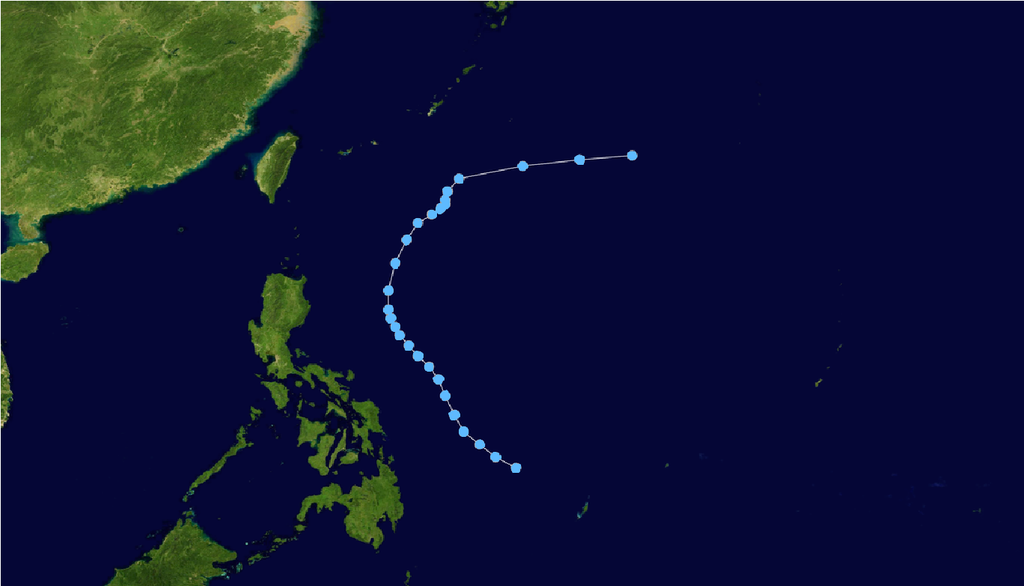
English: Track of 22-W from November 7, 1939 through November 14, 1939. Due to the age at witch this storm was observed from, one cannot rely on this track to be 100% accurate, but rather just a reference as to where the storm happened and the relative direction it traveled. |
||
| 日期 | |||
| 来源 | Track data provided by Ibtracs, land image from NASA | ||
| 作者 | Supportstorm | ||
| 授权 (二次使用本文件) |
|
| Storm data |
|---|
文件历史
点击某个日期/时间查看对应时刻的文件。
| 日期/时间 | 缩略图 | 大小 | 用户 | 备注 | |
|---|---|---|---|---|---|
| 当前 | 2014年7月5日 (六) 20:31 | | 1,366 × 782(315 KB) | Typhoon2013 | Tropical depression right? |
| 2012年2月22日 (三) 22:54 |  | 2,700 × 1,669(1.27 MB) | Supportstorm | {{Information |Description ={{en|1=Track of 22-W from November 7, 1939 through November 14, 1939. Due to the age at witch this storm was observed from, one cannot rely on this track to be 100% accurate, but rather just a reference as to where the st... |
文件用途
以下2个页面使用本文件:
全域文件用途
以下其他wiki使用此文件:
- th.wikipedia.org上的用途