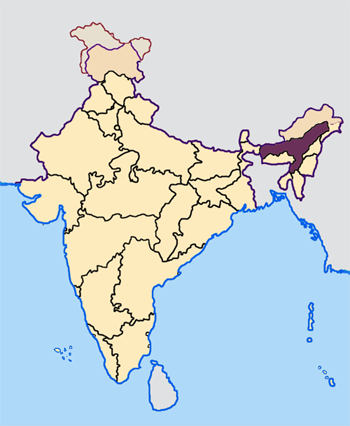
File:Assam in India.png
Assam_in_India.png (350 × 426像素,文件大小:76 KB,MIME类型:image/png)
文件历史
点击某个日期/时间查看对应时刻的文件。
| 日期/时间 | 缩略图 | 大小 | 用户 | 备注 | |
|---|---|---|---|---|---|
| 当前 | 2005年4月23日 (六) 07:27 |  | 350 × 426(76 KB) | Nichalp | NPOV map |
| 2005年4月23日 (六) 07:21 |  | 200 × 231(22 KB) | Kerpal | Reverted to earlier revision | |
| 2005年4月23日 (六) 06:16 |  | 500 × 608(121 KB) | Nichalp | Reverted to earlier revision | |
| 2005年4月23日 (六) 04:59 |  | 200 × 231(22 KB) | Kerpal | Reverted to earlier revision | |
| 2005年4月23日 (六) 04:50 |  | 500 × 608(121 KB) | Nichalp | Reverted to earlier revision | |
| 2005年4月22日 (五) 21:04 |  | 200 × 231(22 KB) | Kerpal | Reverted to earlier revision | |
| 2005年4月22日 (五) 13:39 |  | 500 × 608(121 KB) | Nichalp | Reverted to earlier revision | |
| 2005年4月22日 (五) 13:35 |  | 500 × 608(121 KB) | Nichalp | Reverted to earlier revision | |
| 2005年4月22日 (五) 09:55 |  | 200 × 231(22 KB) | Kerpal | originally by en:User:Morwen | |
| 2005年4月21日 (四) 17:49 |  | 500 × 608(121 KB) | Nichalp | Map made by me, ~~~ Note: The Indian state of w:Jammu and Kashmir is claimed by w:India, w:Pakistan and the w:People's Republic of China. This map depicts the boundaries of the state as it was in 1947. Areas administered by India is colo |
文件用途
以下7个页面使用本文件:
全域文件用途
以下其他wiki使用此文件:
- as.wikipedia.org上的用途
- bn.wikipedia.org上的用途
- bs.wikipedia.org上的用途
- bxr.wikipedia.org上的用途
- en.wikipedia.org上的用途
- Kamarupa
- History of Assam
- Danava dynasty
- Kamata Kingdom
- Timeline of history of Assam
- Dimasa Kingdom
- Assam Movement
- Bhauma dynasty
- Ahom kingdom
- Colonial Assam
- Template:History of Assam
- 2008 Assam bombings
- Chutia Kingdom
- 2009 Guwahati bombings
- 2009 Assam bombings
- 2004 Indian general election in Assam
- 2009 Indian general election in Assam
- Assam separatist movements
- Dark Age of the Assamese language
- 2012 Assam violence
- Koch–Ahom relations
- 2014 Indian general election in Assam
- Asura Kingdom
- Operation Bajrang
- en.wikinews.org上的用途
- hi.wikipedia.org上的用途
- ka.wikipedia.org上的用途
- pl.wikipedia.org上的用途
查看本文件的更多全域用途。


