File:British Islands.svg

此SVG文件的PNG预览的大小:343 × 600像素。 其他分辨率:137 × 240像素 | 274 × 480像素 | 439 × 768像素 | 586 × 1,024像素 | 1,171 × 2,048像素 | 675 × 1,180像素。
原始文件 (SVG文件,尺寸为675 × 1,180像素,文件大小:243 KB)
摘要
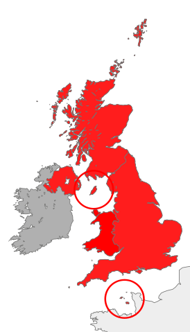
| 描述 | map showing the territory referred to as "the British Islands" in relation to Great Britain and Ireland (namely the United Kingdom plus the Crown Dependencies, but not the Republic of Ireland) |
| 日期 | |
| 来源 | 自己的作品 |
| 作者 | Cnbrb |
| SVG开发 |
许可协议
| 我,本作品著作权人,释出本作品至公有领域。这适用于全世界。 在一些国家这可能不合法;如果是这样的话,那么: 我无条件地授予任何人以任何目的使用本作品的权利,除非这些条件是法律规定所必需的。 |
文件历史
点击某个日期/时间查看对应时刻的文件。
| 日期/时间 | 缩略图 | 大小 | 用户 | 备注 | |
|---|---|---|---|---|---|
| 当前 | 2016年10月28日 (五) 12:45 | | 675 × 1,180(243 KB) | Smyth | Highlight crown dependencies, otherwise map looks identical to File:British Isles United Kingdom.svg at small sizes. |
| 2007年10月20日 (六) 21:32 |  | 675 × 1,180(241 KB) | Cnbrb | == Summary == {{Information |Description=map showing the territory referred to as "the British Islands" in relation to Great Britain and Ireland (namely the United Kingdom plus the Crown Dependencies, but not the Republic of Ireland) |Source=self-made |Da |
文件用途
全域文件用途
以下其他wiki使用此文件:
- cs.wikipedia.org上的用途
- en.wikipedia.org上的用途
- es.wikipedia.org上的用途
- fa.wikipedia.org上的用途
- fr.wiktionary.org上的用途
- he.wikipedia.org上的用途
- hu.wikipedia.org上的用途
- id.wikipedia.org上的用途
- it.wikipedia.org上的用途
- kk.wikipedia.org上的用途
- lt.wikipedia.org上的用途
- ru.wikipedia.org上的用途
- si.wikipedia.org上的用途
- sr.wikipedia.org上的用途
- sv.wikipedia.org上的用途
- tr.wikipedia.org上的用途
- uk.wikipedia.org上的用途
- vi.wikipedia.org上的用途