File:Brokopondo resorts.png
本预览的尺寸:776 × 600像素。 其他分辨率:311 × 240像素 | 621 × 480像素 | 994 × 768像素 | 1,056 × 816像素。
原始文件 (1,056 × 816像素,文件大小:22 KB,MIME类型:image/png)
摘要
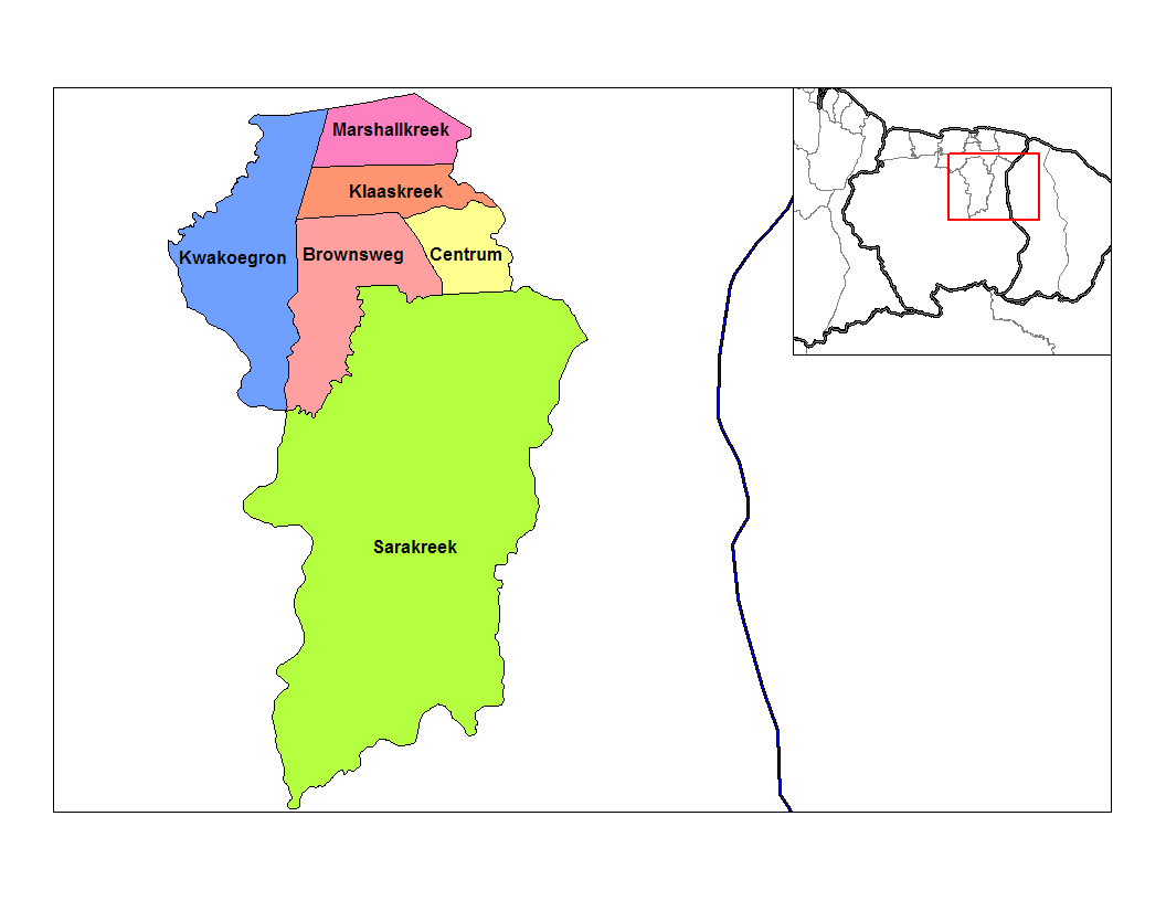
| 描述 | Map of the resorts of the Brokopondo district in Suriname. Created by Rarelibra 22:47, 27 December 2006 (UTC) for public domain use, using MapInfo Professional v8.5 and various mapping resources. Rarelibra 22:47, 27 December 2006 (UTC) |
| 日期 | 2006年12月27日 (原始上传日期) |
| 来源 | 无法识别来源。根据版权声明推断为其自己的作品。 |
| 作者 | 无法识别作者。根据版权声明推断作者为Rarelibra。 |
许可协议
| 我,本作品著作权人,释出本作品至公有领域。这适用于全世界。 在一些国家这可能不合法;如果是这样的话,那么: 我无条件地授予任何人以任何目的使用本作品的权利,除非这些条件是法律规定所必需的。 |
文件历史
点击某个日期/时间查看对应时刻的文件。
| 日期/时间 | 缩略图 | 大小 | 用户 | 备注 | |
|---|---|---|---|---|---|
| 当前 | 2023年6月9日 (五) 00:36 | | 1,056 × 816(22 KB) | SurinameCentral | Reverted to version as of 22:47, 27 December 2006 (UTC) |
| 2023年6月8日 (四) 22:07 |  | 1,056 × 816(89 KB) | SurinameCentral | Reverted to version as of 21:18, 19 March 2023 (UTC) | |
| 2023年6月7日 (三) 18:21 |  | 1,056 × 816(22 KB) | DutchDaan | Rarelibra version reinstated. Suriname borders have not changed. | |
| 2023年3月19日 (日) 21:18 |  | 1,056 × 816(89 KB) | SurinameCentral | resort map in the corner was updated | |
| 2006年12月27日 (三) 22:47 |  | 1,056 × 816(22 KB) | Rarelibra | Map of the resorts of the Brokopondo district in Suriname. Created by ~~~~ for public domain use, using MapInfo Professional v8.5 and various mapping resources. ~~~~ |
文件用途
没有页面链接到本图像。
全域文件用途
以下其他wiki使用此文件:
- en.wikipedia.org上的用途
- es.wikipedia.org上的用途