File:Canada Atlantic provinces map.png
此为最大尺寸。
Canada_Atlantic_provinces_map.png (262 × 212像素,文件大小:4 KB,MIME类型:image/png)
摘要
| 描述 |
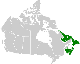
English: Map of the Atlantic provinces. See Image:Canada provinces blank vide.png for additional information.
Français : Carte des provinces Atlantiques. Voir Image:Canada provinces blank vide.png pour de renseignements supplémentaires. |
| 日期 | 2005年9月24日 (原始上传日期) |
| 来源 | 无法识别来源。根据版权声明推断为其自己的作品。 |
| 作者 | 无法识别作者。根据版权声明推断作者为QuartierLatin1968。 |
许可协议
| 我,本作品著作权人,释出本作品至公有领域。这适用于全世界。 在一些国家这可能不合法;如果是这样的话,那么: 我无条件地授予任何人以任何目的使用本作品的权利,除非这些条件是法律规定所必需的。 |
文件历史
点击某个日期/时间查看对应时刻的文件。
| 日期/时间 | 缩略图 | 大小 | 用户 | 备注 | |
|---|---|---|---|---|---|
| 当前 | 2005年9月24日 (六) 02:17 | | 262 × 212(4 KB) | QuartierLatin1968 | * {{english}} Map of the Atlantic provinces. See Image:Canada provinces blank vide.png for additional information. * {{français}} Carte des provinces Atlantiques. Voir Image:Canada provinces blank vide.png pour de renseignements supplémentaire |
文件用途
没有页面链接到本图像。
全域文件用途
以下其他wiki使用此文件:
- ast.wikipedia.org上的用途
- de.wikipedia.org上的用途
- en.wikipedia.org上的用途
- es.wikipedia.org上的用途
- fr.wikipedia.org上的用途
- gl.wikipedia.org上的用途
- pt.wikipedia.org上的用途
- sv.wikipedia.org上的用途