File:Covent Garden from the Ralph Agas 1572 map of London - marked.jpg
本预览的尺寸:800 × 536像素。 其他分辨率:320 × 214像素 | 640 × 429像素 | 821 × 550像素。
原始文件 (821 × 550像素,文件大小:524 KB,MIME类型:image/jpeg)
| 描述 |
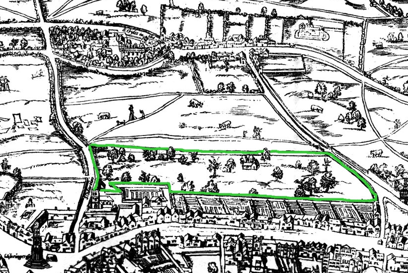
Small detail of the Ralph Agas London map of 1572. Modern marks in green of streets, and in yellow of Covent Garden wall. English: The earliest proper map (as opposed to panorama) of London known. Attributed to Ralph Agas, and probably surveyed between 1570 and 1605. The original was 6 foot 0.5 inches long by 2 feet 4.5 inches wide. This much reduced image is a scan of a copy of a lithograph of a copy, was itself badly repaired with sellotape and has had to be "restored"; so is hardly a truly faithful representation of the original, but few good copies exist and no other detailed public domain images are known. |
| 日期 | (UTC) |
| 来源 | |
| 作者 |
|
| 这是一张修改过的图片,这意味着它已在原版本的基础上通过软件进行了编辑,改动内容:Covent Garden marked in green。其原始版本为:Covent Garden from the Ralph Agas 1572 map of London.jpg。修改者: SilkTork。
|
原始上传日志
This image is a derivative work of the following images:
- File:Covent_Garden_from_the_Ralph_Agas_1572_map_of_London.jpg licensed with PD-self
- 2010-08-12T18:15:34Z SilkTork 821x550 (545301 Bytes) {{Information |Description=Small detail of the Ralph Agas London map of 1572. Modern marks in green of streets, and in yellow of Covent Garden wall. {{en|1=The earliest proper map (as opposed to panorama) of London known. A
Uploaded with derivativeFX
文件历史
点击某个日期/时间查看对应时刻的文件。
| 日期/时间 | 缩略图 | 大小 | 用户 | 备注 | |
|---|---|---|---|---|---|
| 当前 | 2010年8月23日 (一) 07:35 | | 821 × 550(524 KB) | SilkTork | {{Information |Description=Small detail of the Ralph Agas London map of 1572. Modern marks in green of streets, and in yellow of Covent Garden wall. {{en|1=The earliest proper map (as opposed to panorama) of London known. Attributed to Ralph Agas, and p |
文件用途
以下页面使用本文件:
全域文件用途
以下其他wiki使用此文件:
- ar.wikipedia.org上的用途
- azb.wikipedia.org上的用途
- en.wikipedia.org上的用途
- ja.wikipedia.org上的用途
- pt.wikipedia.org上的用途
- ru.wikipedia.org上的用途
- vi.wikipedia.org上的用途