File:Dardanelles landsat.jpg
此为最大尺寸。
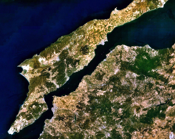
Dardanelles_landsat.jpg (737 × 584像素,文件大小:593 KB,MIME类型:image/jpeg)
摘要
| 描述 |
English: Landsat 7 image of the Dardanelles and Gallipoli Peninsula, Turkey. |
|||
| 日期 | ||||
| 来源 | Captured and cropped from NASA World Wind. | |||
| 作者 | NASA | |||
| 授权 (二次使用本文件) |
|

文件历史
点击某个日期/时间查看对应时刻的文件。
| 日期/时间 | 缩略图 | 大小 | 用户 | 备注 | |
|---|---|---|---|---|---|
| 当前 | 2013年9月26日 (四) 03:06 | | 737 × 584(593 KB) | Jahoe | improved colour |
| 2006年9月17日 (日) 12:53 |  | 737 × 584(205 KB) | ChrisO | NASA Landsat 7 image of the Dardanelles and Gallipoli Peninsula, Turkey. Category:Satellite images of peninsulas |
文件用途
全域文件用途
以下其他wiki使用此文件:
- af.wikipedia.org上的用途
- an.wikipedia.org上的用途
- ar.wikipedia.org上的用途
- arz.wikipedia.org上的用途
- ast.wikipedia.org上的用途
- azb.wikipedia.org上的用途
- be-tarask.wikipedia.org上的用途
- be.wikipedia.org上的用途
- bg.wikipedia.org上的用途
- bo.wikipedia.org上的用途
- ca.wikipedia.org上的用途
- ceb.wikipedia.org上的用途
- ckb.wikipedia.org上的用途
- co.wikipedia.org上的用途
- cs.wikipedia.org上的用途
- cy.wikipedia.org上的用途
- de.wikipedia.org上的用途
- el.wikipedia.org上的用途
- en.wikipedia.org上的用途
- eo.wikipedia.org上的用途
- eo.wikiquote.org上的用途
- es.wikipedia.org上的用途
- eu.wikipedia.org上的用途
- fa.wikipedia.org上的用途
- fr.wikipedia.org上的用途
- ga.wikipedia.org上的用途
- gl.wikipedia.org上的用途
- he.wikipedia.org上的用途
- ja.wikipedia.org上的用途
- kk.wikipedia.org上的用途
- ku.wikipedia.org上的用途
- ky.wikipedia.org上的用途
- lb.wikipedia.org上的用途
- nn.wikipedia.org上的用途
- no.wikipedia.org上的用途
- pl.wikipedia.org上的用途
查看本文件的更多全域用途。