File:Freiburg Breisgau um 1900.jpg
本预览的尺寸:800 × 576像素。 其他分辨率:320 × 231像素 | 640 × 461像素 | 1,024 × 738像素 | 1,280 × 922像素 | 2,560 × 1,844像素 | 3,474 × 2,503像素。
原始文件 (3,474 × 2,503像素,文件大小:2.79 MB,MIME类型:image/jpeg)
摘要
| 描述 |
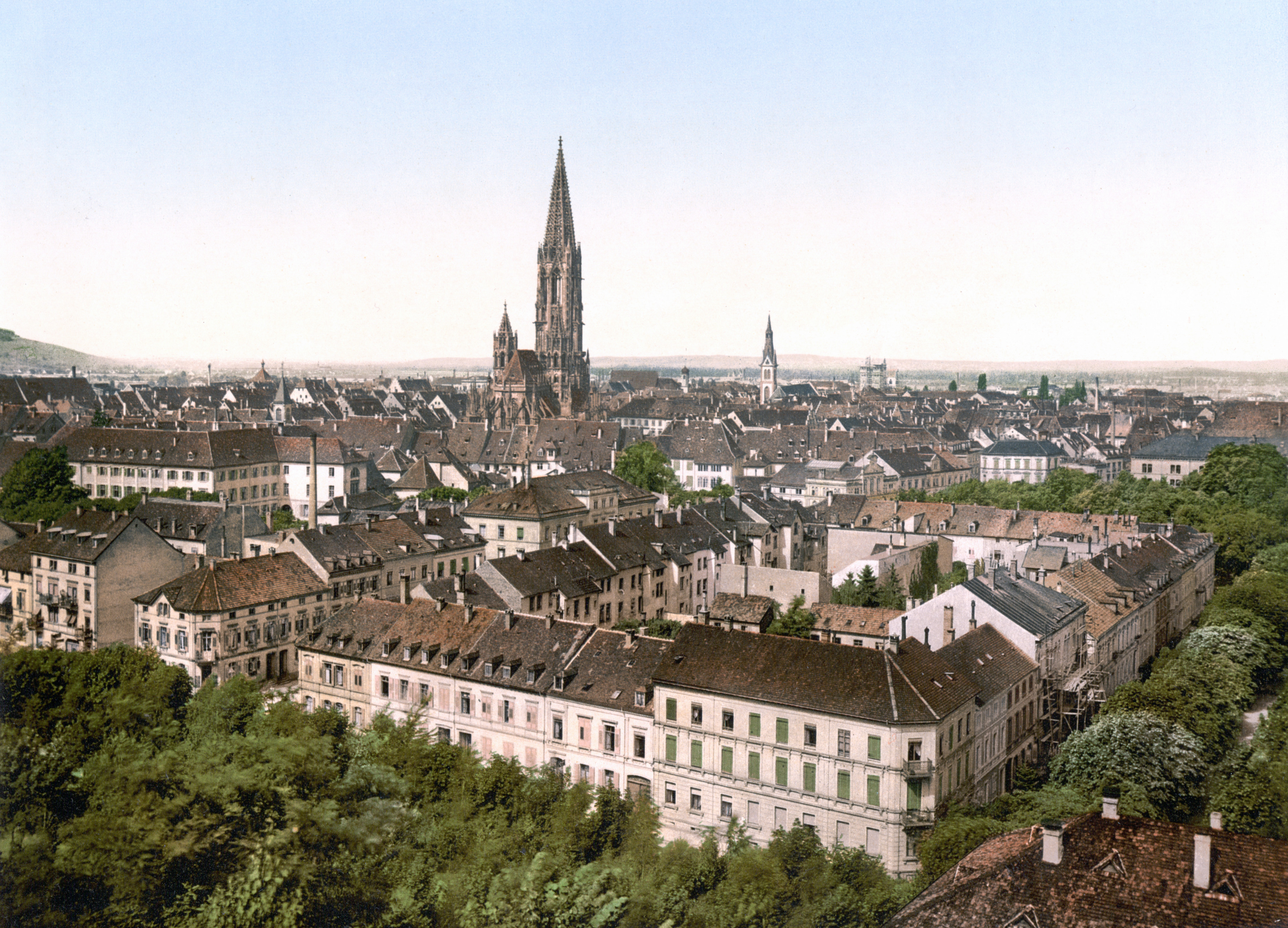
Deutsch: Freiburg im Breisgau um 1900 |
||
| 日期 | 在1890年到1905年之间 | ||
| 来源 |
Original image: Photochrom print (color photo lithograph)
|
||
| 作者 | 未知 | ||
| 授权 (二次使用本文件) |
"Photographs in this collection were published before 1929 and are therefore in the public domain." |

许可协议
- For photochroms by the Detroit Publishing Co.
- For photochroms by the Photoglob AG
The author of this image from Switzerland is unknown, and the image was published at least 70 years ago. It is therefore in the public domain in Switzerland by virtue of Art. 31 of the Swiss Copyright Act.
|
 |
| 相机位置 | | 在以下服务上查看本图像和附近其他图像: OpenStreetMap |
|---|
文件历史
点击某个日期/时间查看对应时刻的文件。
| 日期/时间 | 缩略图 | 大小 | 用户 | 备注 | |
|---|---|---|---|---|---|
| 当前 | 2008年8月28日 (四) 08:49 | | 3,474 × 2,503(2.79 MB) | Jan Arkesteijn | rotated left, removed yellow tone, cropped according to directions in Category:Images with watermarks |
| 2008年7月4日 (五) 15:39 |  | 974 × 724(200 KB) | LFaraone | croppped [using an external editor] | |
| 2008年7月4日 (五) 15:38 |  | 1,024 × 771(211 KB) | LFaraone | using an external editor | |
| 2007年6月21日 (四) 11:19 |  | 1,024 × 771(211 KB) | Tohma | {{Information |Description= |Source= |Date= |Author= |Permission= |other_versions= }} | |
| 2006年1月25日 (三) 20:56 |  | 640 × 482(89 KB) | Maksim | La bildo estas kopiita de wikipedia:de. La originala priskribo estas: Freiburg im Breisgau um 1900 Public Domain Quelle: http://hdl.loc.gov/loc.pnp/ppmsca.00298 {{PD}} {| border="1" ! date/time || username || edit summary |---- | 02:01, 6. Jan 2006 | |
文件用途
全域文件用途
以下其他wiki使用此文件:
- ar.wikipedia.org上的用途
- de.wikipedia.org上的用途
- el.wikipedia.org上的用途
- en.wikipedia.org上的用途
- eo.wikipedia.org上的用途
- es.wikipedia.org上的用途
- fr.wikipedia.org上的用途
- hy.wikipedia.org上的用途
- ja.wikipedia.org上的用途
- no.wikipedia.org上的用途
- pt.wikipedia.org上的用途
- ro.wikipedia.org上的用途
- sl.wikipedia.org上的用途