File:GCHQ-aerial.jpg
本预览的尺寸:800 × 563像素。 其他分辨率:320 × 225像素 | 640 × 451像素 | 1,024 × 721像素 | 1,280 × 902像素 | 2,560 × 1,803像素 | 3,000 × 2,113像素。
原始文件 (3,000 × 2,113像素,文件大小:2.19 MB,MIME类型:image/jpeg)
摘要
| 描述 |
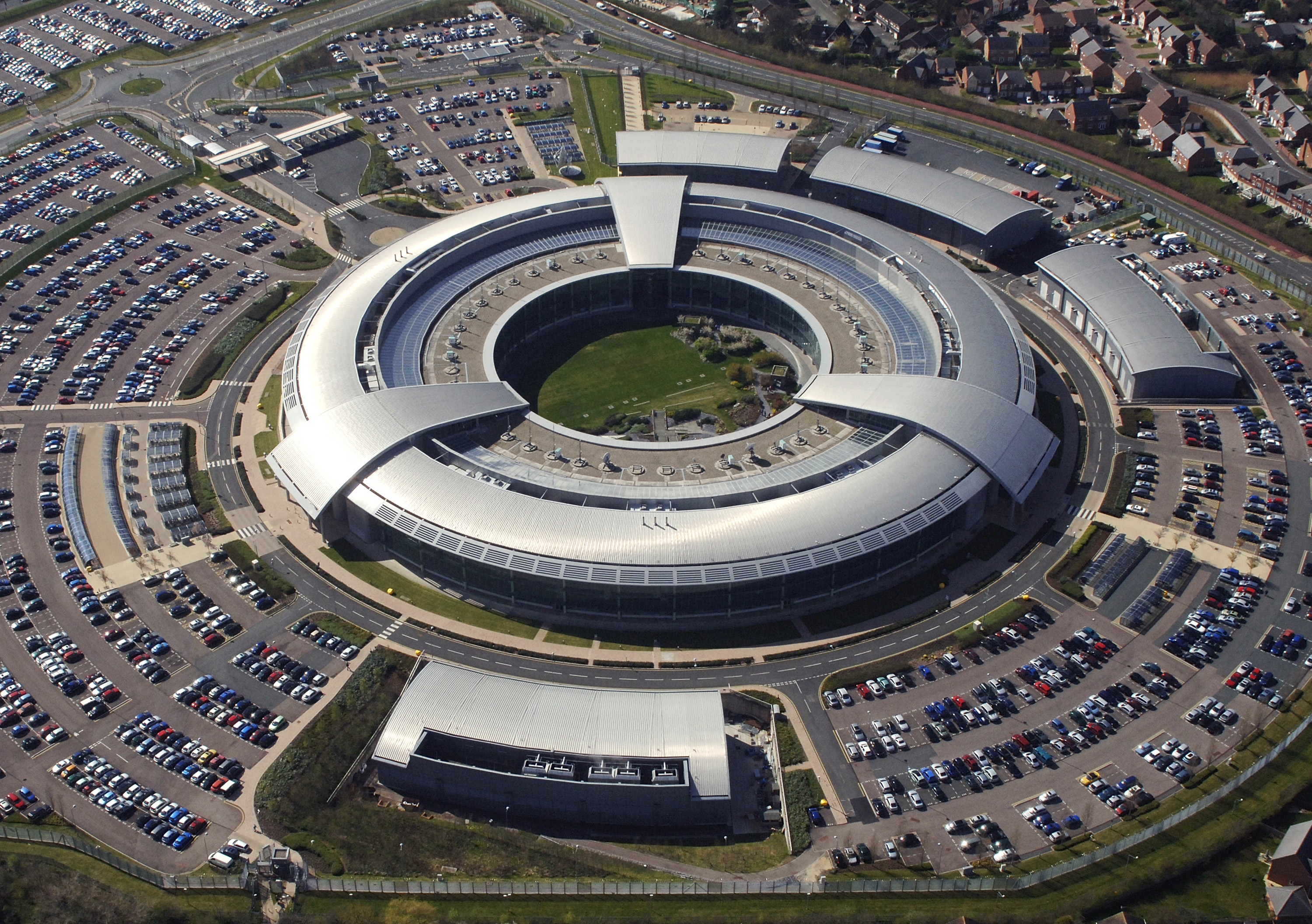
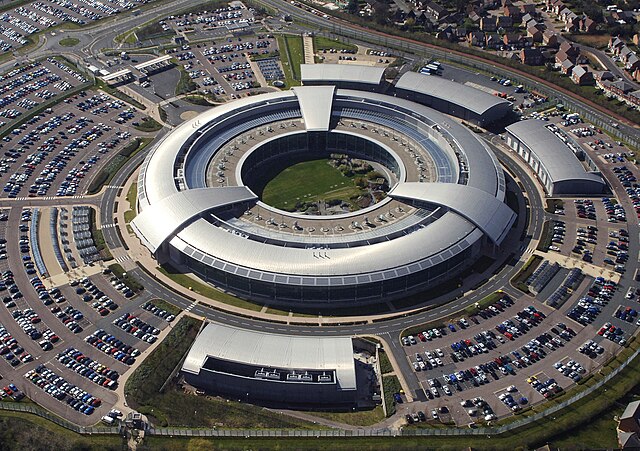
English: An aerial image of the Government Communications Headquarters (GCHQ) in Cheltenham, Gloucestershire. |
| 日期 | |
| 来源 | http://www.defenceimagery.mod.uk/ |
| 作者 | Ministry of Defence |
| 相机位置 | | 在以下服务上查看本图像和附近其他图像: OpenStreetMap |
|---|
许可协议
.svg)
|
此文件已根据开放政府许可证1.0版 (OGL v1.0)。
|
|---|---|
|
您可以自由:
有关更多信息,请参阅元维基上的开放政府许可证页面。
|
文件历史
点击某个日期/时间查看对应时刻的文件。
| 日期/时间 | 缩略图 | 大小 | 用户 | 备注 | |
|---|---|---|---|---|---|
| 当前 | 2012年9月21日 (五) 17:31 | | 3,000 × 2,113(2.19 MB) | Liandrei | {{Information |Description ={{en|1=An aerial image of the Government Communications Headquarters (GCHQ) in Cheltenham, Gloucestershire. GCHQ is one of the three UK Intelligence Agencies and forms a crucial part of the UK’s National Intelligence an... |
文件用途
全域文件用途
以下其他wiki使用此文件:
- af.wikipedia.org上的用途
- ar.wikipedia.org上的用途
- azb.wikipedia.org上的用途
- bg.wikipedia.org上的用途
- bs.wikipedia.org上的用途
- cs.wikipedia.org上的用途
- da.wikipedia.org上的用途
- de.wikipedia.org上的用途
- de.wikinews.org上的用途
- en.wikipedia.org上的用途
- South West England
- Carillion
- Five Eyes
- Threshold issues in Singapore administrative law
- Tempora
- Wikipedia:Recent additions/2014/January
- The Doughnut
- Template:Did you know nominations/The Doughnut
- Wikipedia:Surveillance awareness day/Brainstorming phase
- User:Sgconlaw/Threshold issues in Singapore administrative law
- en.wikivoyage.org上的用途
- es.wikipedia.org上的用途
- et.wikipedia.org上的用途
- fa.wikipedia.org上的用途
- fi.wikipedia.org上的用途
- fr.wikipedia.org上的用途
- he.wikipedia.org上的用途
- hr.wikipedia.org上的用途
查看本文件的更多全域用途。