File:GeneralMapOfDistancesAndHistoricCapitals.jpg
本预览的尺寸:744 × 599像素。 其他分辨率:298 × 240像素 | 596 × 480像素 | 953 × 768像素 | 1,271 × 1,024像素 | 2,542 × 2,048像素 | 3,493 × 2,814像素。
原始文件 (3,493 × 2,814像素,文件大小:6.14 MB,MIME类型:image/jpeg)
摘要
许可协议
|
这是一个平面公有领域艺术品的忠实摄影副本。原艺术品本身因为下列原因属于公有领域:
维基媒体基金会的官方立场认为:“对平面公有领域艺术品的忠实再制作品也属于公有领域。”
因此,可以认为此摄影副本在美国也属于公有领域。在其他司法管辖区,再利用此内容可能存在限制;参见再利用PD-Art照片了解详细信息。 |
文件历史
点击某个日期/时间查看对应时刻的文件。
| 日期/时间 | 缩略图 | 大小 | 用户 | 备注 | |
|---|---|---|---|---|---|
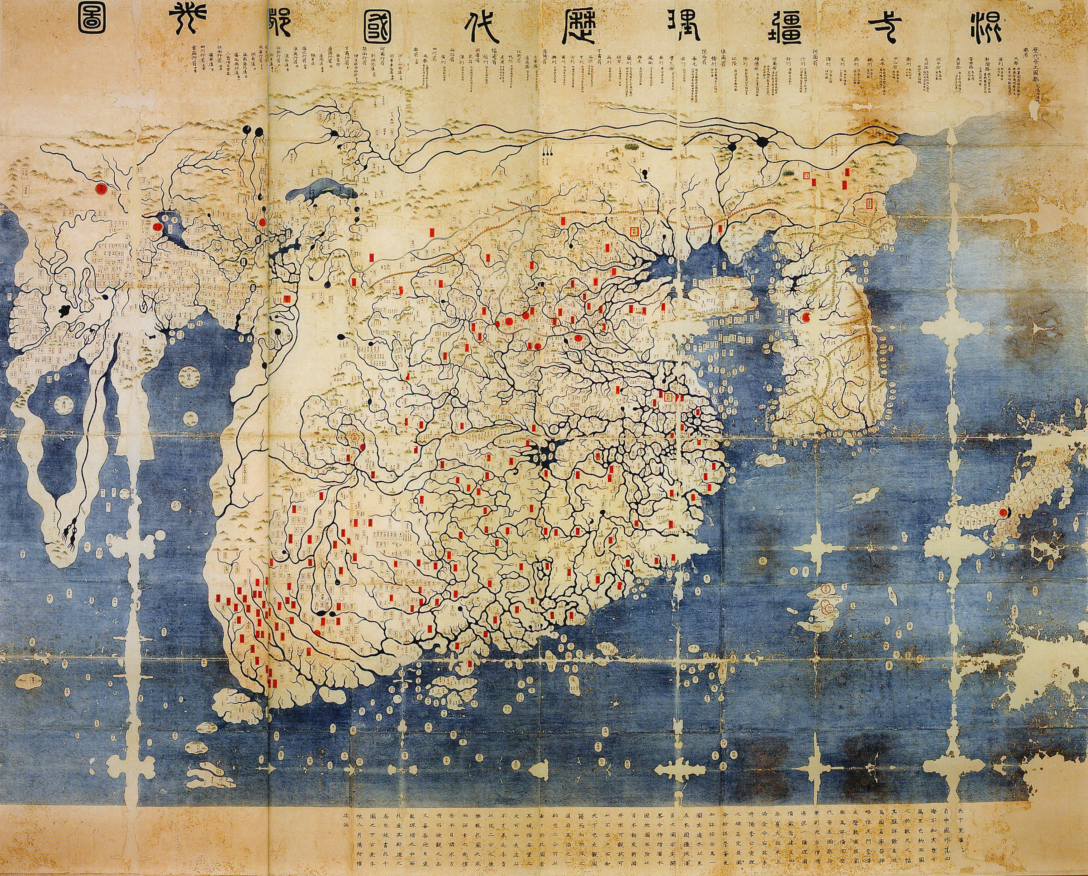
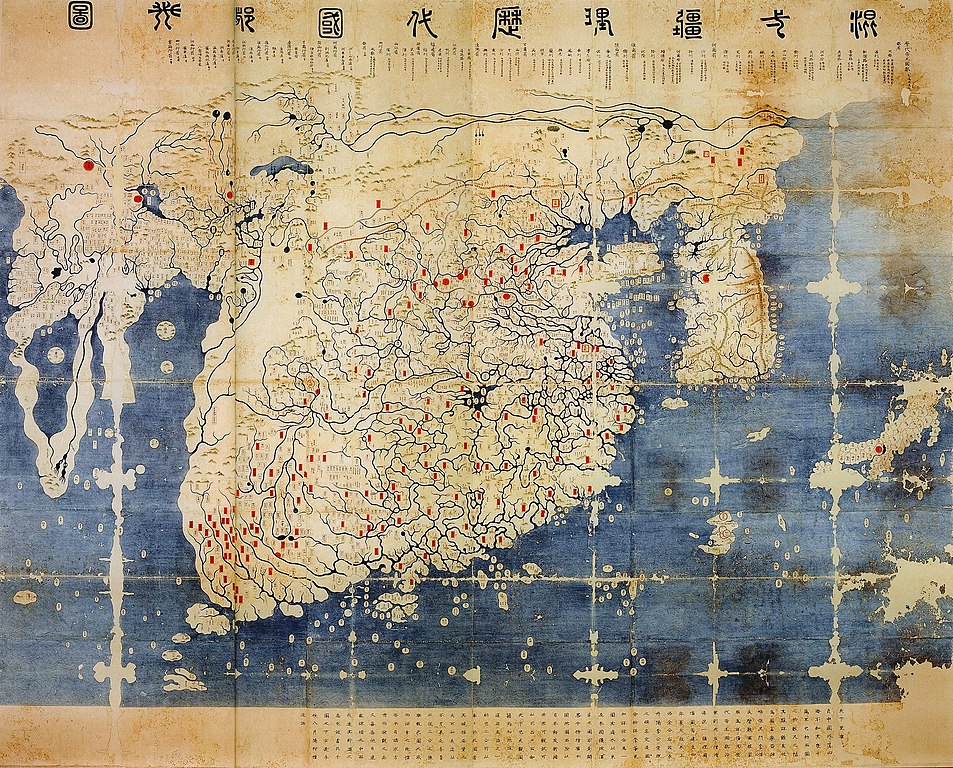
| 当前 | 2008年6月11日 (三) 14:40 | | 3,493 × 2,814(6.14 MB) | Yaan | == Summary == {{Information |Description = General map of the distances and the historic capitals (chinese: Hunyi jiangli lidai guodu zhi tu; japanese: Kon'itsu kyoori rekidai kokuto no zu), Korea, roughly 1470. Ink and paint on paper. Height 220 cm, widt |
文件用途
以下页面使用本文件:
全域文件用途
以下其他wiki使用此文件:
- en.wikipedia.org上的用途
- fr.wikipedia.org上的用途
- fr.wikiversity.org上的用途
- ko.wikipedia.org上的用途
- ru.wikipedia.org上的用途
- uk.wikipedia.org上的用途
- www.wikidata.org上的用途