File:Golan 92.jpg

本预览的尺寸:475 × 599像素。 其他分辨率:190 × 240像素 | 380 × 480像素 | 1,000 × 1,262像素。
原始文件 (1,000 × 1,262像素,文件大小:236 KB,MIME类型:image/jpeg)
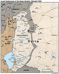
map of Golan Heights ; from w:Image:Golan_92.jpg ; CIA ; PD
Tulsa City County Library's record for the image has the following information: [1]
| Corp author | United States. Central Intelligence Agency. |
| Title | Israeli settlements in the Golan Heights, February 1992. |
| Published | Washington, D.C. : Central Intelligence Agency, 1992 |
| Map format | Scale [ca. 1:410,000] |
| Description | 1 map : col. ; 21 x 17 cm. |
| Note | "724711 (R00412) 4-92." |
User:Thuresson 06:57, 19 Feb 2005 (UTC)
此作品在美国属于公有领域,因为其是由美国政府的官员或雇员,基于其个人公务目的制作的作品,参考美国法典第17篇第1章第105条。
注意︰本模板仅适用于美国联邦政府的原创作品,不适用于任何美国州、属地、联邦个体、县、市或任何次级政府的作品。本模板也不适用于1978年以后由美国邮政署出版的邮票图案(参看美国版权局实践纲领第313.6(C)(1)条)。也不适用于部分美国硬币;参看美国铸币局使用条款。 |
 | |
| 本文件已被确认为免除已知的著作权法限制(包括所有相关权利)。 | ||
文件历史
点击某个日期/时间查看对应时刻的文件。
| 日期/时间 | 缩略图 | 大小 | 用户 | 备注 | |
|---|---|---|---|---|---|
| 当前 | 2015年3月1日 (日) 13:40 | | 1,000 × 1,262(236 KB) | Danny lost | bigger |
| 2005年2月20日 (日) 13:04 |  | 650 × 785(91 KB) | Mats Halldin~commonswiki | map of Golan Heights ; from w:Image:Golan_92.jpg ; CIA ; PD {{PD}} |
文件用途
全域文件用途
以下其他wiki使用此文件:
- ar.wikipedia.org上的用途
- arz.wikipedia.org上的用途
- azb.wikipedia.org上的用途
- bs.wikipedia.org上的用途
- ca.wikipedia.org上的用途
- ckb.wikipedia.org上的用途
- cs.wikipedia.org上的用途
- cy.wikipedia.org上的用途
- da.wikipedia.org上的用途
- de.wikipedia.org上的用途
- de.wikinews.org上的用途
- en.wikipedia.org上的用途
- Israeli settlement
- User:John Z/drafts/Golan Heights
- Israeli-occupied territories
- United Nations Security Council Resolution 398
- United Nations Security Council Resolution 408
- United Nations Security Council Resolution 420
- User:Gimmetrow/test
- User:Gimmetrow/test2
- United Nations Security Council Resolution 679
- User:Bolter21/Userboxes/GolanHeighstIsrael
- User:Bolter21/Userboxes/GolanHeightsSyria
- User:Bolter21/Userboxes
- User:Falcaorib
- User:Carthago814
- eo.wikipedia.org上的用途
- es.wikipedia.org上的用途
- et.wikipedia.org上的用途
- eu.wikipedia.org上的用途
- fa.wikipedia.org上的用途
- fr.wikipedia.org上的用途
- fr.wikinews.org上的用途
- hr.wikipedia.org上的用途
- hu.wikipedia.org上的用途
查看本文件的更多全域用途。