File:HR Gustav 2002.jpg
本预览的尺寸:600 × 600像素。 其他分辨率:240 × 240像素 | 480 × 480像素 | 768 × 768像素 | 1,024 × 1,024像素 | 2,048 × 2,048像素 | 4,500 × 4,500像素。
原始文件 (4,500 × 4,500像素,文件大小:3.84 MB,MIME类型:image/jpeg)
摘要
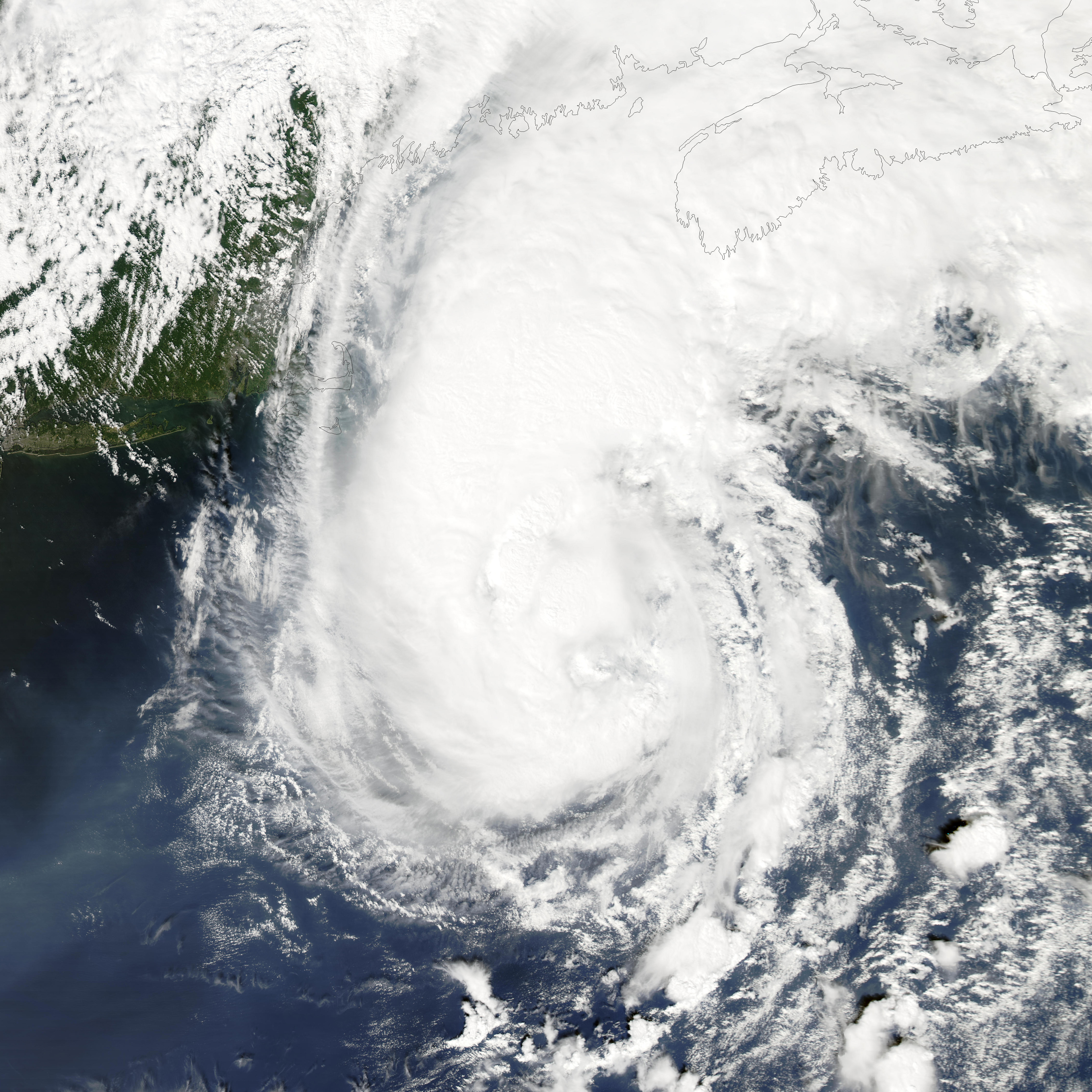
| 描述 | After hugging the Eastern seaboard for several days as a tropical storm, the storm called Gustav finally made Hurricane status on September 11, 2002, as it moved away from the Maryland and Delaware coasts. The storm eventually made landfall in southwestern Newfoundland on September 12, 2002. This image was acquired by the Moderate Resolution Imaging Spectroradiometer (MODIS) instrument on the Aqua satellite. | |||||
| 日期 | ||||||
| 来源 | http://visibleearth.nasa.gov/view_rec.php?id=3888 | |||||
| 作者 | Jacques Descloitres, MODIS Land Rapid Response Team, NASA/GSFC | |||||
| 授权 (二次使用本文件) |
|
|||||
| 其他版本 | Image:Hurricane Gustav 11 sept 2002 1800Z.jpg |

文件历史
点击某个日期/时间查看对应时刻的文件。
| 日期/时间 | 缩略图 | 大小 | 用户 | 备注 | |
|---|---|---|---|---|---|
| 当前 | 2010年1月2日 (六) 18:56 | | 4,500 × 4,500(3.84 MB) | Supportstorm | Reverted to version as of 21:55, 26 September 2006 |
| 2009年12月28日 (一) 04:09 |  | 4,500 × 4,500(3.93 MB) | Supportstorm | Image Touch up | |
| 2006年9月26日 (二) 21:55 |  | 4,500 × 4,500(3.84 MB) | Coredesat | ||
| 2006年9月26日 (二) 21:46 |  | 7,800 × 6,000(6.56 MB) | Coredesat | {{Information |Description=MODIS satellite image of Hurricane Gustav off the coast of New England in 2002. |Source=[http://rapidfire.sci.gsfc.nasa.gov/gallery/?2002254-0911/Gustav.A2002254.1800.250m.jpg NASA Modis Rapid Response System] |Date=2002-09-11 | |
文件用途
以下15个页面使用本文件:
- 2002年大西洋颶風季
- 2002年大西洋飓风季时间轴
- 颶風古斯塔夫 (2002年)
- Talk:颶風古斯塔夫 (2002年)
- User:J87j8787/12
- Wikipedia:优良条目/2014年3月
- Wikipedia:优良条目/2014年3月8日
- Wikipedia:优良条目/飓风古斯塔夫 (2002年)
- Wikipedia:典范条目/2002年飓风古斯塔夫
- Wikipedia:典范条目/2014年2月
- Wikipedia:典范条目/2014年2月18日
- Wikipedia:典范条目/2015年8月
- Wikipedia:典范条目/2015年8月8日
- Portal:美國/特色條目
- Portal:美國/特色條目/80
全域文件用途
以下其他wiki使用此文件:
- ar.wikipedia.org上的用途
- en.wikipedia.org上的用途
- 2002 Atlantic hurricane season
- Hurricane Gustav (2002)
- Portal:Tropical cyclones/Featured article/Hurricane Gustav (2002)
- Timeline of the 2002 Atlantic hurricane season
- Wikipedia:Today's featured article/September 2012
- Wikipedia:Today's featured article/September 8, 2012
- Wikipedia:Main Page history/2012 September 8
- es.wikipedia.org上的用途
- fr.wikipedia.org上的用途
- pt.wikipedia.org上的用途
- simple.wikipedia.org上的用途