File:Haiti deforestation.jpg
本预览的尺寸:800 × 600像素。 其他分辨率:320 × 240像素 | 640 × 480像素 | 1,024 × 768像素 | 1,280 × 960像素 | 2,560 × 1,920像素。
原始文件 (2,560 × 1,920像素,文件大小:1.48 MB,MIME类型:image/jpeg)
| 描述 |
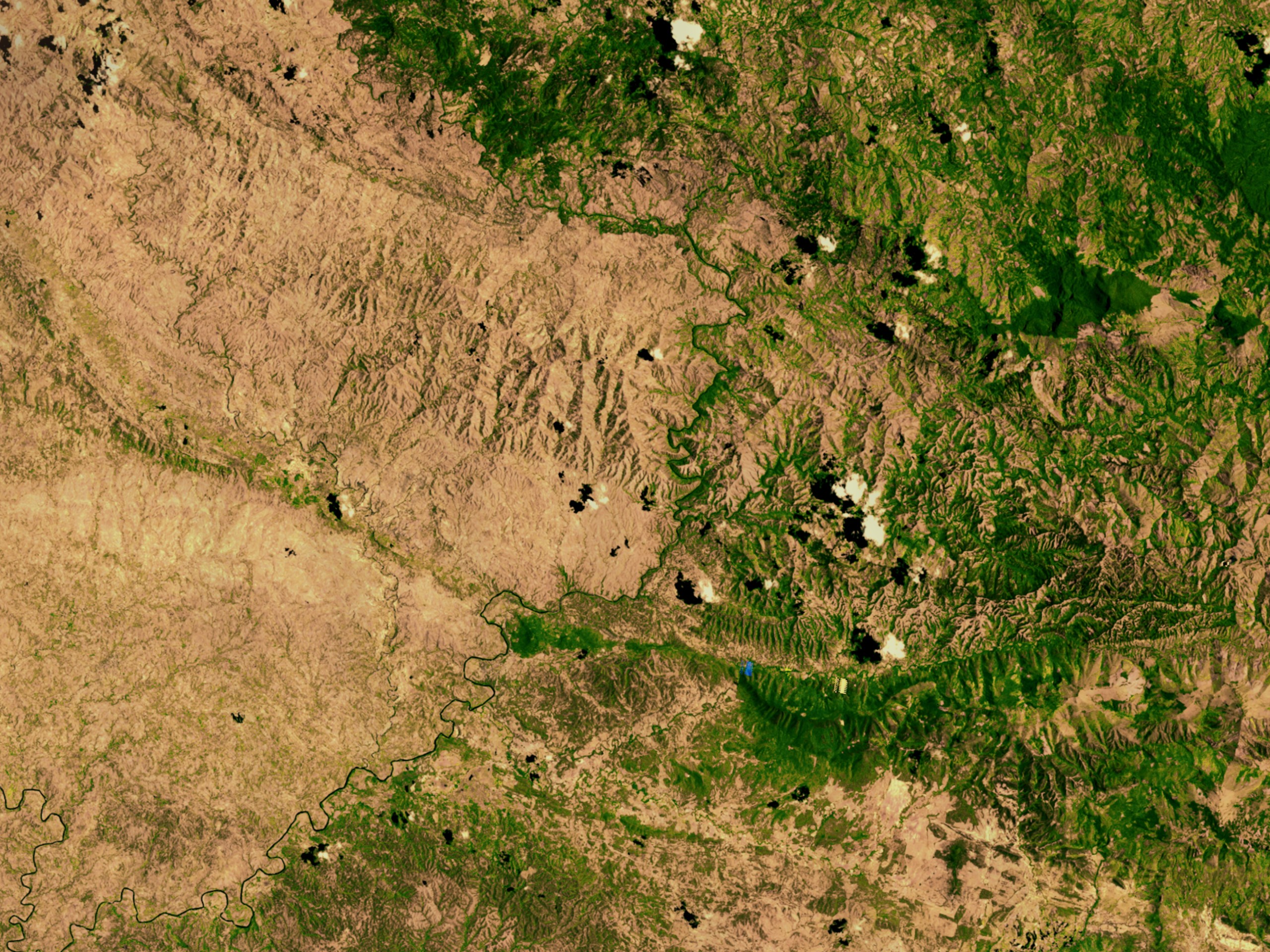
English: Satellite image showing deforestation in Haiti, Haiti-Centre. This image depicts the border between Haiti (left) and the Dominican Republic (right). |
|||||
| 日期 | ||||||
| 来源 | http://svs.gsfc.nasa.gov/vis/a000000/a002600/a002640/ | |||||
| 作者 | NASA | |||||
| 授权 (二次使用本文件) |
|

| 物体位置 | | 在以下服务上查看本图像和附近其他图像: OpenStreetMap |
|---|
文件历史
点击某个日期/时间查看对应时刻的文件。
| 日期/时间 | 缩略图 | 大小 | 用户 | 备注 | |
|---|---|---|---|---|---|
| 当前 | 2008年3月10日 (一) 02:54 | | 2,560 × 1,920(1.48 MB) | Calliopejen | {{Information |Description=Satellite image showing deforestation in Haiti. This image depicts the border between Haiti (left) and the Dominican Republic (right). |Source=http://svs.gsfc.nasa.gov/vis/a000000/a002600/a002640/ |Date=2002-09-25 |Author=NASA | |
文件用途
全域文件用途
以下其他wiki使用此文件:
- af.wikipedia.org上的用途
- ar.wikipedia.org上的用途
- ast.wikipedia.org上的用途
- az.wikipedia.org上的用途
- be.wikipedia.org上的用途
- cs.wikipedia.org上的用途
- de.wikipedia.org上的用途
- de.wiktionary.org上的用途
- en.wikipedia.org上的用途
- en.wikinews.org上的用途
- es.wikipedia.org上的用途
- eu.wikipedia.org上的用途
- fa.wikipedia.org上的用途
- fr.wikipedia.org上的用途
- fr.wikiversity.org上的用途
- ht.wikipedia.org上的用途
- ig.wikipedia.org上的用途
- kk.wikipedia.org上的用途
- la.wikipedia.org上的用途
- mt.wikipedia.org上的用途
- nn.wikipedia.org上的用途
- no.wikipedia.org上的用途
- oc.wikipedia.org上的用途
- pa.wikipedia.org上的用途
- pl.wikipedia.org上的用途
- pt.wikipedia.org上的用途
- pt.wikibooks.org上的用途
- ru.wikipedia.org上的用途
- te.wikipedia.org上的用途
查看本文件的更多全域用途。