File:Han dynasty Kingdoms 195 BC.png
本预览的尺寸:530 × 599像素。 其他分辨率:212 × 240像素 | 424 × 480像素 | 679 × 768像素 | 905 × 1,024像素 | 1,483 × 1,677像素。
原始文件 (1,483 × 1,677像素,文件大小:736 KB,MIME类型:image/png)
摘要
| 描述 |
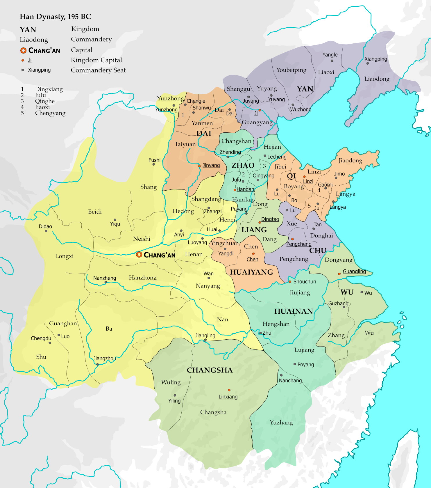
English: The map represents the situation of Western Han dynasty in the 12th year of Emperor Gao (195 BC). 10 kingdoms existed within the Han empire at the time, and with the exception of Changsha, all are headed by members of the imperial family. 15 commanderies in the central and western parts of the empire were directly administered by the imperial government.
The borders are based on Zhou Zhenhe's Xihan Zhengqu Dili (西汉政区地理, "Administrative Geography of Western Han"), 1987.
This file is the png version of File:Han dynasty Kingdoms 195 BC.svg. |
| 日期 | |
| 来源 |
个人作品,使用:
|
| 作者 | Esiymbro |
| 其他版本 |
[]
|


许可协议
我,本作品著作权人,特此采用以下许可协议发表本作品:
本文件采用知识共享署名-相同方式共享 4.0 国际许可协议授权。
- 您可以自由地:
- 共享 – 复制、发行并传播本作品
- 修改 – 改编作品
- 惟须遵守下列条件:
- 署名 – 您必须对作品进行署名,提供授权条款的链接,并说明是否对原始内容进行了更改。您可以用任何合理的方式来署名,但不得以任何方式表明许可人认可您或您的使用。
- 相同方式共享 – 如果您再混合、转换或者基于本作品进行创作,您必须以与原先许可协议相同或相兼容的许可协议分发您贡献的作品。
文件历史
点击某个日期/时间查看对应时刻的文件。
| 日期/时间 | 缩略图 | 大小 | 用户 | 备注 | |
|---|---|---|---|---|---|
| 当前 | 2019年11月10日 (日) 14:42 | | 1,483 × 1,677(736 KB) | Esiymbro | User created page with UploadWizard |
文件用途
没有页面链接到本图像。
全域文件用途
以下其他wiki使用此文件:
- ckb.wikipedia.org上的用途
- en.wikipedia.org上的用途
- es.wikipedia.org上的用途
- fa.wikipedia.org上的用途
- gl.wikipedia.org上的用途
- id.wikipedia.org上的用途
- mt.wikipedia.org上的用途
- my.wikipedia.org上的用途
- pl.wikipedia.org上的用途
- si.wikipedia.org上的用途
- sl.wikipedia.org上的用途
- vi.wikipedia.org上的用途