File:Historisch Nordamerika.jpg
本预览的尺寸:731 × 600像素。 其他分辨率:293 × 240像素 | 585 × 480像素 | 936 × 768像素 | 1,248 × 1,024像素 | 2,497 × 2,048像素 | 2,560 × 2,100像素。
原始文件 (2,560 × 2,100像素,文件大小:6.03 MB,MIME类型:image/jpeg)
摘要
| 描述 |
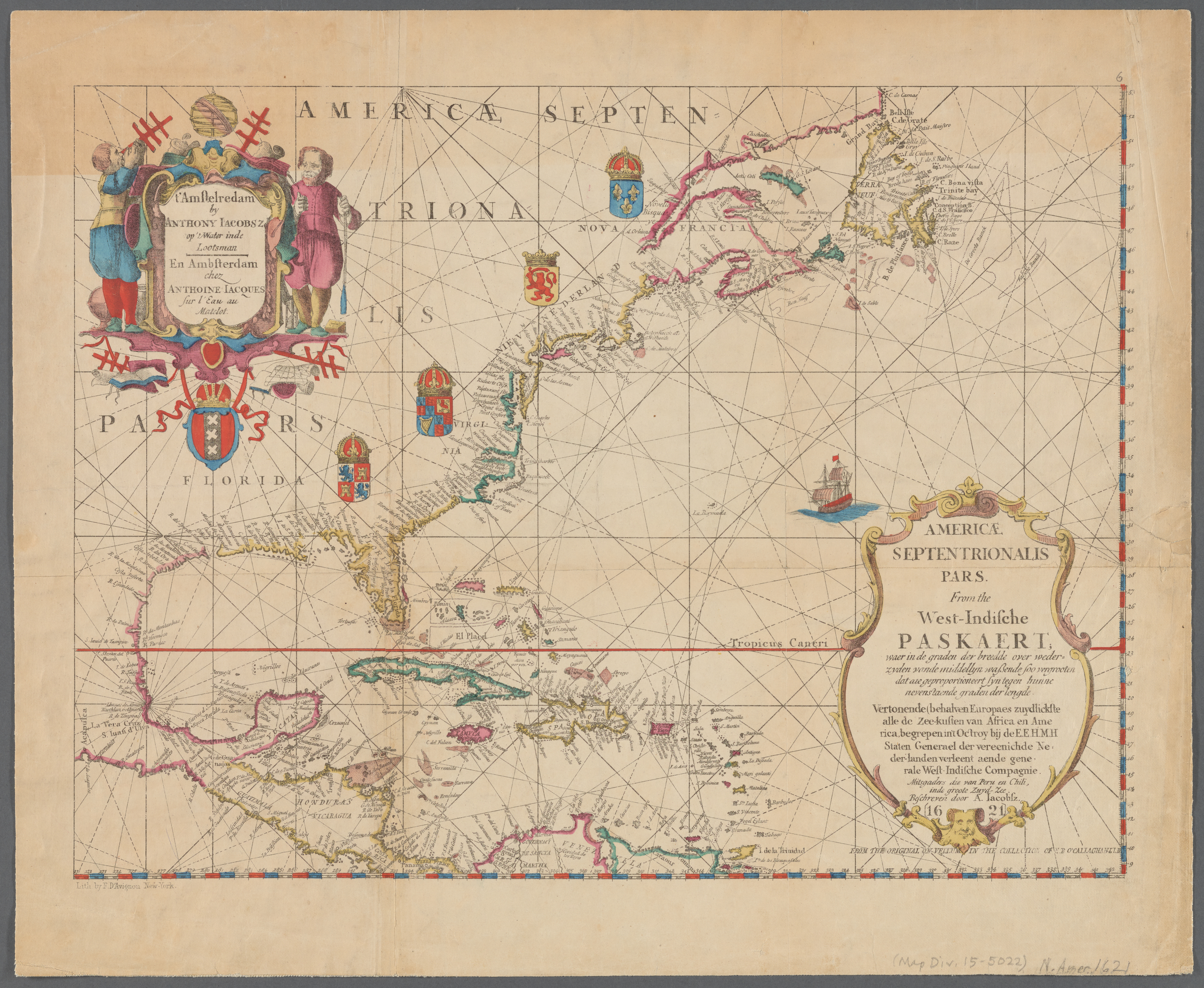
English: Old map of North America, the Caribbean, and northern South America; covers area north from Venezuela to Labrador; includes decorative cartouches and illustrations. This is a facsimile, from the original on vellum in the collection of E.B. O'Callaghan LLD.
|
||
| 日期 | |||
| 来源 |
|
||
| 作者 |
Anthoni Jacobsz (1594-1624), cartographer Francis D'Avignon (1813–1875), lithographer E.B. (Edmund Bailey) O'Callaghan (1797–1880), collector |
||
| 其他版本 |
|
.jpg)

.jpg)
许可协议
|
本作品在其来源国以及其他著作权期限是作者逝世后100年或以下的国家和地区属于公有领域。 | |
| 本文件已被确认为免除已知的著作权法限制(包括所有相关权利)。 | |
文件历史
点击某个日期/时间查看对应时刻的文件。
| 日期/时间 | 缩略图 | 大小 | 用户 | 备注 | |
|---|---|---|---|---|---|
| 当前 | 2021年1月10日 (日) 23:55 | | 2,560 × 2,100(6.03 MB) | Vzeebjtf | larger, higher resolution |
| 2013年9月13日 (五) 21:43 |  | 400 × 314(83 KB) | Gladiool | Same image, higher quality. | |
| 2005年10月2日 (日) 20:14 |  | 382 × 269(38 KB) | Newsflash | 16 or 17 century old map |
文件用途
没有页面链接到本图像。
全域文件用途
以下其他wiki使用此文件:
- bn.wikipedia.org上的用途
- ka.wikipedia.org上的用途
- km.wikipedia.org上的用途