File:Historische kaart Vijfheerenlanden (16e eeuw).jpg
本预览的尺寸:630 × 599像素。 其他分辨率:252 × 240像素 | 505 × 480像素 | 808 × 768像素 | 1,077 × 1,024像素 | 2,154 × 2,048像素 | 2,953 × 2,808像素。
原始文件 (2,953 × 2,808像素,文件大小:5.68 MB,MIME类型:image/jpeg)
.jpg?uselang=zh)
.jpg?uselang=zh)
.jpg?action=history&uselang=zh)
.jpg)
| 描述 |
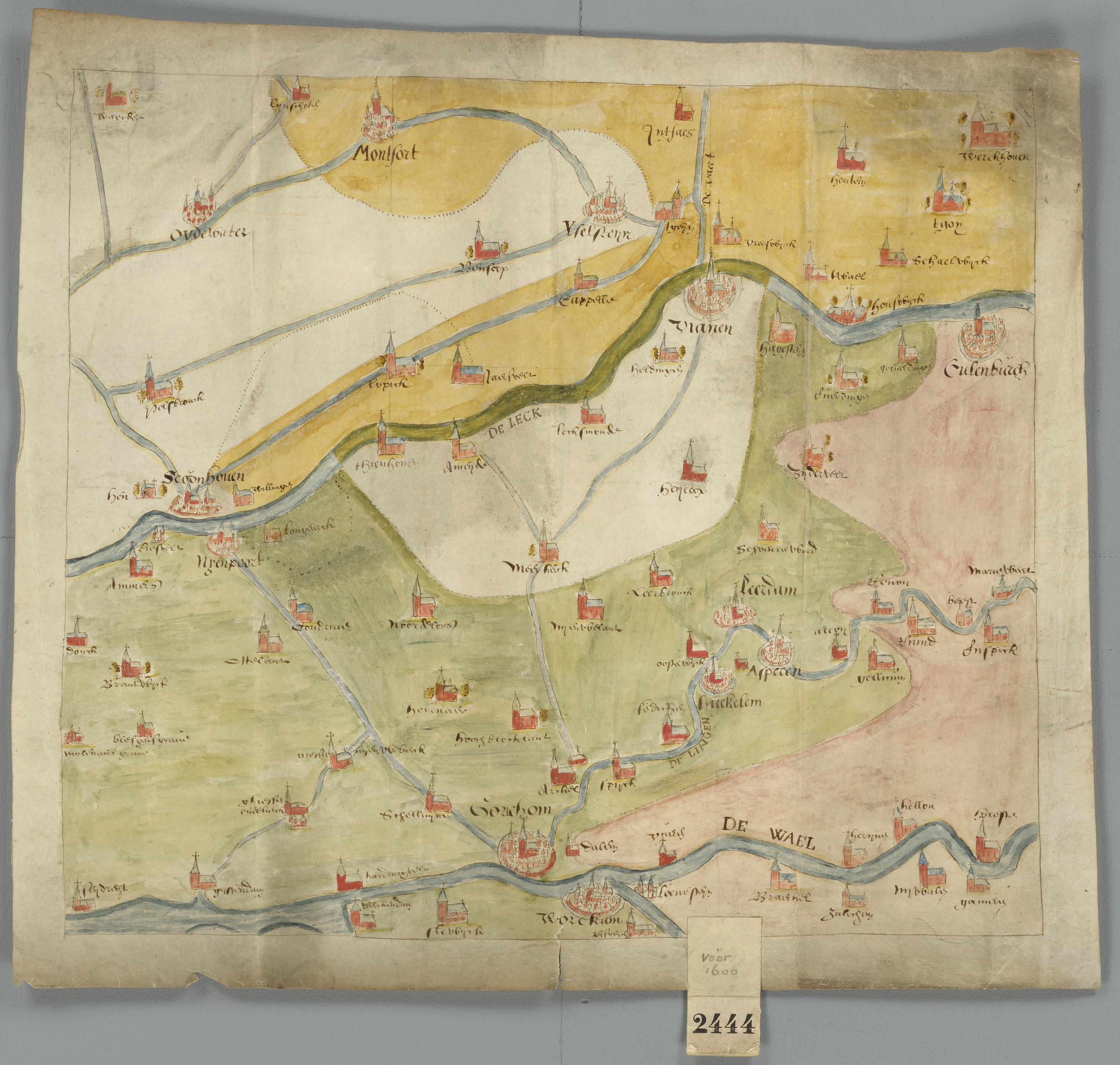
Kaart van de Vijfheerenlanden en de aangrenzende landen, uit de 16de eeuw Deze kaart is onderdeel van de Verzameling Binnenlandse Kaarten Hingman. Deze collectie is door het Provinciaal Historisch Centrum Zuid-Holland gedigitaliseerd, ten behoeve van de website www.geschiedenisvanzuidholland.nl. De collectie wordt bewaard bij het Nationaal Archief. |
||||||
| 日期 | 16世纪 | ||||||
| 来源 | Flickr: Historische kaart Vijfheerenlanden (16e eeuw) | ||||||
| 作者 | Provinciaal Historisch Centrum Zuid-Holland | ||||||
| 授权 (二次使用本文件) |
|
||||||
| 註解 | 該圖片含有註解:在維基媒體共享資源上查看註解 |
.jpg)
文件历史
点击某个日期/时间查看对应时刻的文件。
| 日期/时间 | 缩略图 | 大小 | 用户 | 备注 | |
|---|---|---|---|---|---|
| 当前 | 2017年10月20日 (五) 21:55 | | 2,953 × 2,808(5.68 MB) | VortBot | Uploading higher resolution from Flickr |
| 2012年12月30日 (日) 11:01 |  | 1,024 × 974(558 KB) | Flickr upload bot | Uploaded from http://flickr.com/photo/32562899@N06/3874176206 using Flickr upload bot |
文件用途
以下页面使用本文件:
全域文件用途
以下其他wiki使用此文件:
- ar.wikipedia.org上的用途
- en.wikipedia.org上的用途
- fa.wikipedia.org上的用途
- fr.wikipedia.org上的用途
- id.wikipedia.org上的用途
- nl.wikipedia.org上的用途
.jpg)