File:Frances 2004-08-31 1755Z (cropped).jpg

本预览的尺寸:600 × 600像素。 其他分辨率:240 × 240像素 | 480 × 480像素 | 768 × 768像素 | 1,024 × 1,024像素 | 2,048 × 2,048像素 | 5,000 × 5,000像素。
原始文件 (5,000 × 5,000像素,文件大小:4.25 MB,MIME类型:image/jpeg)
摘要
| 描述 |
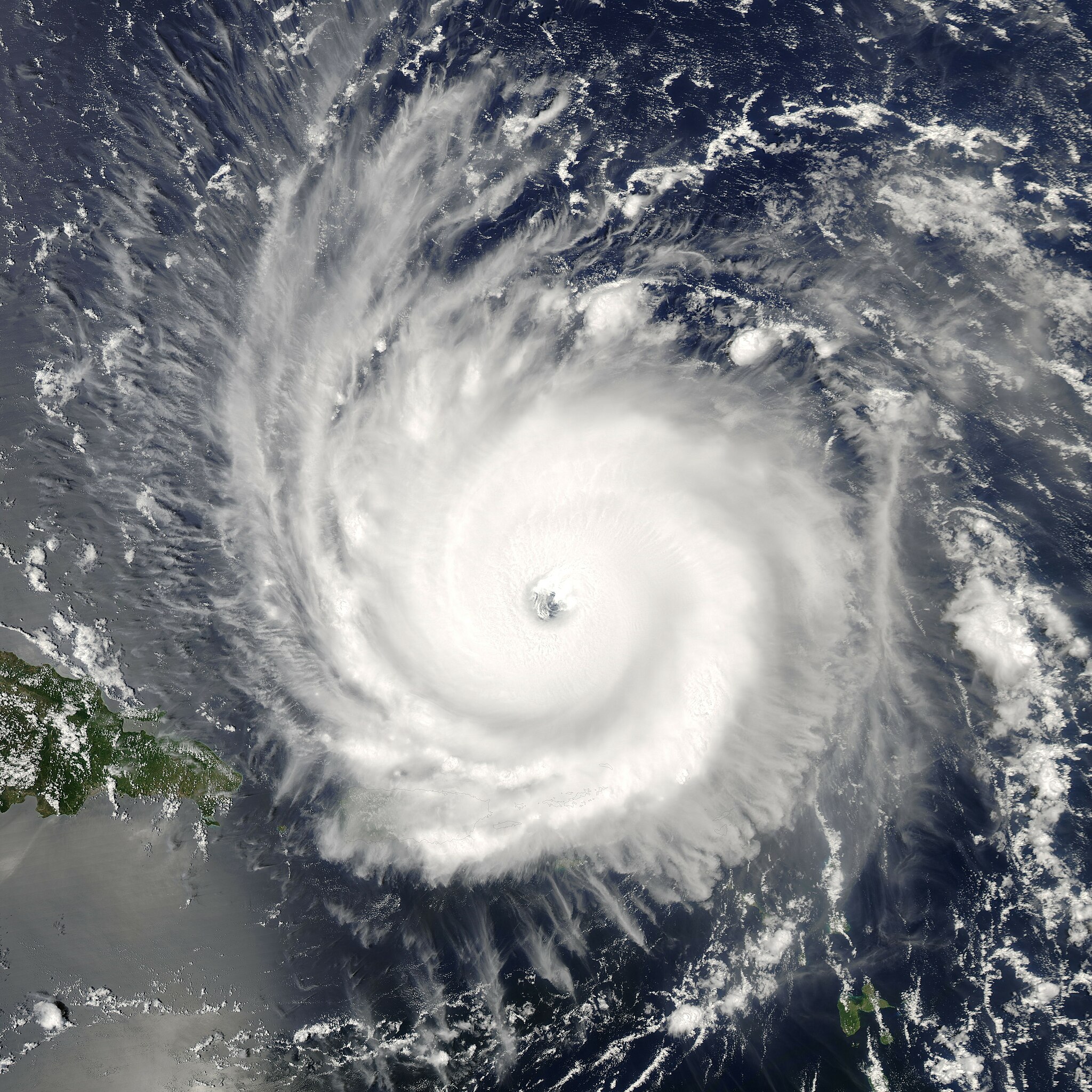
The MODIS instrument aboard NASA's Aqua satellite captured this true-color image of Hurricane Frances on August 31, 2004 at 17:55 UTC (1:55 PM EDT). At the time this image was taken Frances was located approximately 230 km (140 miles) north-northeast of San Juan, Puerto Rico and was moving towards the west near 26 km/hr (16 mph). Maximum sustained winds were near 225 km/hr (140 mph) and the storm's minimum central pressure was down to 942 millibars. The MODIS Rapid Response System provides this image at additional resolutions and formats. |
|||||
| 日期 | ||||||
| 来源 | http://visibleearth.nasa.gov/view_rec.php?id=6584 | |||||
| 作者 | Jacques Descloitres, MODIS Rapid Response Team, NASA/GSFC | |||||
| 授权 (二次使用本文件) |
|
|||||
| 其他版本 | Image:Frances 2004 near Hispaniola.jpg |

.jpg?uselang=zh)
.jpg?uselang=zh)
.jpg?action=history&uselang=zh)
.jpg)
文件历史
点击某个日期/时间查看对应时刻的文件。
| 日期/时间 | 缩略图 | 大小 | 用户 | 备注 | |
|---|---|---|---|---|---|
| 当前 | 2006年8月17日 (四) 21:06 | | 5,000 × 5,000(4.25 MB) | Good kitty | == Summary == {{Information |Description=The MODIS instrument aboard NASA's Aqua satellite captured this true-color image of Hurricane Frances on August 31, 2004 at 17:55 UTC (1:55 PM EDT). At the time this image was taken Frances was located approximatel |
文件用途
以下2个页面使用本文件:
全域文件用途
以下其他wiki使用此文件:
- de.wikipedia.org上的用途
- en.wikipedia.org上的用途
- fr.wikipedia.org上的用途
- ko.wikipedia.org上的用途
- pl.wikipedia.org上的用途
- pt.wikipedia.org上的用途
- simple.wikipedia.org上的用途
.jpg)