File:Karta ID RajaAmpat Isl.PNG
此为最大尺寸。
Karta_ID_RajaAmpat_Isl.PNG (450 × 600像素,文件大小:19 KB,MIME类型:image/png)
文件历史
点击某个日期/时间查看对应时刻的文件。
| 日期/时间 | 缩略图 | 大小 | 用户 | 备注 | |
|---|---|---|---|---|---|
| 当前 | 2023年6月19日 (一) 11:01 | | 450 × 600(19 KB) | Hobe | higher accuracy |
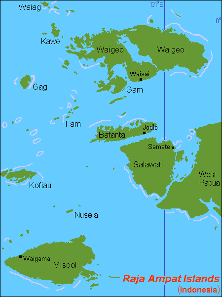
| 2007年7月8日 (日) 18:00 |  | 450 × 600(21 KB) | Hobe | {{Information |Description=map Raja Ampat islands, Indonesia |Source=self-made, composed from various mapreferences |Date=2007-07-07 |Author= Hobe Category:Maps of Indonesia }} |
文件用途
全域文件用途
以下其他wiki使用此文件:
- ar.wikipedia.org上的用途
- arz.wikipedia.org上的用途
- ast.wikipedia.org上的用途
- az.wikipedia.org上的用途
- bg.wikipedia.org上的用途
- bm.wikipedia.org上的用途
- bn.wikipedia.org上的用途
- ca.wikipedia.org上的用途
- ceb.wikipedia.org上的用途
- cs.wikipedia.org上的用途
- cv.wikipedia.org上的用途
- de.wikipedia.org上的用途
查看本文件的更多全域用途。