File:Kazakhstan location map.svg

此SVG文件的PNG预览的大小:800 × 457像素。 其他分辨率:320 × 183像素 | 640 × 366像素 | 1,024 × 585像素 | 1,280 × 732像素 | 2,560 × 1,463像素 | 1,984 × 1,134像素。
原始文件 (SVG文件,尺寸为1,984 × 1,134像素,文件大小:634 KB)
摘要
| 描述 |
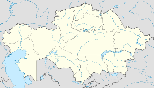
Deutsch: Positionskarte von Kasachstan
Quadratische Plattkarte, N-S-Streckung 150 %. Geographische Begrenzung der Karte:
English: Location map of Kazakhstan
Equirectangular projection, N/S stretching 150 %. Geographic limits of the map:
|
|
| 日期 | ||
| 来源 |
自己的作品, using
|
|
| 作者 | NordNordWest | |
| 授权 (二次使用本文件) |
本文件采用知识共享署名-相同方式共享 3.0 德国许可协议授权。
 本文件采用知识共享署名-相同方式共享 3.0 德国许可协议授权。
|


|
|
文件历史
点击某个日期/时间查看对应时刻的文件。
| 日期/时间 | 缩略图 | 大小 | 用户 | 备注 | |
|---|---|---|---|---|---|
| 当前 | 2010年8月1日 (日) 18:48 | | 1,984 × 1,134(634 KB) | NordNordWest | upd |
| 2009年11月27日 (五) 19:15 |  | 1,985 × 1,134(949 KB) | NordNordWest | c | |
| 2009年11月24日 (二) 12:42 |  | 1,984 × 1,134(942 KB) | NordNordWest | c | |
| 2009年11月24日 (二) 12:38 |  | 1,985 × 1,134(941 KB) | NordNordWest | ||
| 2009年11月23日 (一) 18:41 |  | 1,985 × 1,134(516 KB) | NordNordWest | =={{int:filedesc}}== {{Information |Description= {{de|Positionskarte von Kasachstan, '''Vorversion'''}} Quadratische Plattkarte, N-S-Streckung 150 %. Geographische Begrenzung der Karte: * N: 56° N * S: 40° N * W: 46° O * O: 88° O {{ |
文件用途
没有页面链接到本图像。
全域文件用途
以下其他wiki使用此文件:
- av.wikipedia.org上的用途
- bg.wikinews.org上的用途
- de.wikipedia.org上的用途
- es.wikipedia.org上的用途
- fr.wikipedia.org上的用途
- incubator.wikimedia.org上的用途
- kaa.wikipedia.org上的用途
- lv.wikipedia.org上的用途
- mt.wikipedia.org上的用途
- pt.wikipedia.org上的用途
- rue.wikipedia.org上的用途
- ru.wikipedia.org上的用途
- sk.wikipedia.org上的用途