File:Location map Hong Kong urban core.png

本预览的尺寸:523 × 600像素。 其他分辨率:209 × 240像素 | 418 × 480像素 | 670 × 768像素 | 893 × 1,024像素 | 1,786 × 2,048像素 | 4,580 × 5,253像素。
原始文件 (4,580 × 5,253像素,文件大小:11.55 MB,MIME类型:image/png)
摘要
| 描述 |
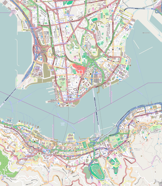
English: Map of the Hong Kong urban core
Geographic limits of the map:
|
| 日期 | |
| 来源 | OpenStreetMap (direct link) |
| 作者 | OpenStreetMap editors |
许可协议
| 此作品内含来自OpenStreetMap贡献者的地图资料,以开放数据库许可证(ODbL)释出。
对于从ODbL数据生成的地图,ODbL不需要任何特定许可。在2020年8月1日之前,OpenStreetMap基金会制作的地图图块已根据CC-BY-SA-2.0许可证授权。其他人制作的地图可能需要获得其他许可。 |
文件历史
点击某个日期/时间查看对应时刻的文件。
| 日期/时间 | 缩略图 | 大小 | 用户 | 备注 | |
|---|---|---|---|---|---|
| 当前 | 2014年10月24日 (五) 14:56 | | 4,580 × 5,253(11.55 MB) | Jc86035 | Replaced with version one zoom up and rendered pixel-doubled in Inkscape, and also using the default tiles instead of MapQuest's because the latter are copyrighted by MapQuest and not CC-BY-SA. |
| 2014年10月7日 (二) 11:48 |  | 645 × 741(831 KB) | Underbar dk | User created page with UploadWizard |
文件用途
以下11个页面使用本文件:
全域文件用途
以下其他wiki使用此文件:
- ar.wikipedia.org上的用途
- en.wikipedia.org上的用途
- The Peninsula Hong Kong
- Prince Edward station
- Mong Kok station
- Yau Ma Tei station
- Central station (MTR)
- East Tsim Sha Tsui station
- Admiralty station (MTR)
- Hong Kong station
- Whampoa station
- Ho Man Tin station
- Tsim Sha Tsui station
- Jordan station
- Sheung Wan station
- Wan Chai station
- Causeway Bay station
- Tin Hau station
- Fortress Hill station
- North Point station
- Olympic station
- Exhibition Centre station (MTR)
- Kowloon station (MTR)
- Mong Kok East station
- Hung Hom station
- Tamar station
- Hong Kong Cultural Centre
- Austin station (MTR)
- Cordis Hong Kong
- Sung Wong Toi station
- To Kwa Wan station
- Causeway Bay North station
- User:KX675/Sandbox
- 2014 Hong Kong protests
- Module:Location map/data/Hong Kong urban core
- Module:Location map/data/Hong Kong urban core/doc
- eo.wikipedia.org上的用途
- fa.wikipedia.org上的用途
- fr.wikipedia.org上的用途
- ja.wikipedia.org上的用途
查看本文件的更多全域用途。