File:MSH80 mailboxes along cowlitz river 1980.jpg
本预览的尺寸:800 × 522像素。 其他分辨率:320 × 209像素 | 640 × 418像素 | 1,024 × 668像素 | 1,280 × 835像素 | 2,919 × 1,905像素。
原始文件 (2,919 × 1,905像素,文件大小:1.78 MB,MIME类型:image/jpeg)
摘要
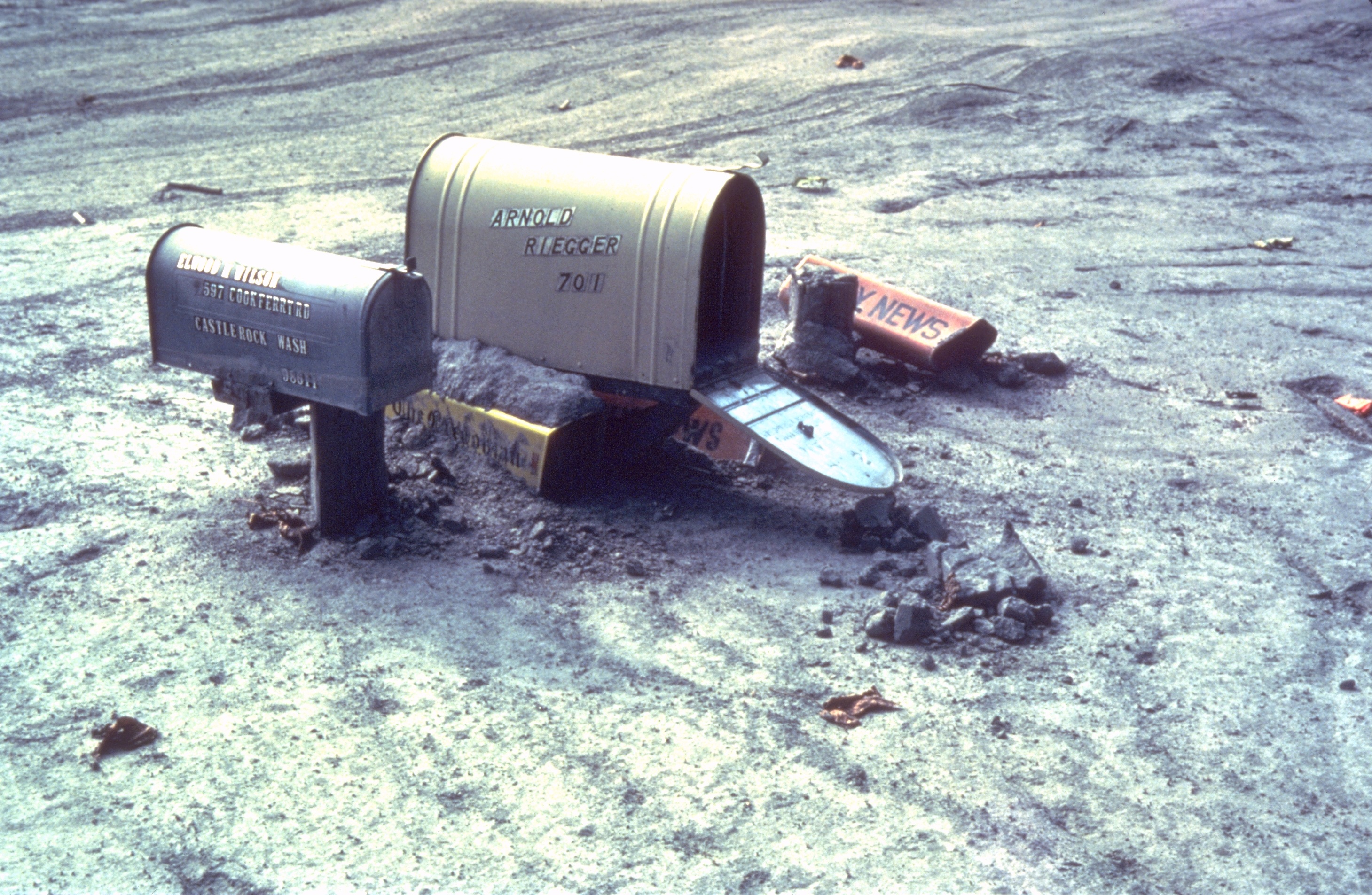
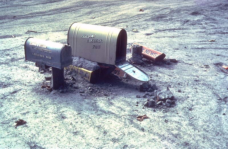
| 描述 | Mailboxes sticking out of a mudflow along the Cowlitz River in Castle Rock, Washington after the May 18, 1980 explosion of Mount St. Helens |
| 日期 | 1980年年夏季 |
| 来源 | Archived source link |
| 作者 | Lyn Topinka, USGS |
| 相机位置 | | 在以下服务上查看本图像和附近其他图像: OpenStreetMap |
|---|
许可协议
|
|
文件历史
点击某个日期/时间查看对应时刻的文件。
| 日期/时间 | 缩略图 | 大小 | 用户 | 备注 | |
|---|---|---|---|---|---|
| 当前 | 2006年3月31日 (五) 17:28 | | 2,919 × 1,905(1.78 MB) | Mnh | ==English== {{Information| |Description=Mailboxes in the mudflow along the Cowlitz River created by the May 18th, 1980 eruption of the Mount St. Helens. |Source=[http://vulcan.wr.usgs.gov/Volcanoes/MSH/Images/mudflow_images.html USGS Cascades Volcano Obse |
文件用途
没有页面链接到本图像。
全域文件用途
以下其他wiki使用此文件:
- ar.wikipedia.org上的用途
- de.wikipedia.org上的用途
- en.wikipedia.org上的用途
- eo.wikipedia.org上的用途
- es.wikipedia.org上的用途
- fr.wikipedia.org上的用途
- fy.wikipedia.org上的用途
- id.wikipedia.org上的用途
- ig.wikipedia.org上的用途
- ka.wikipedia.org上的用途
- ko.wikipedia.org上的用途
- la.wikipedia.org上的用途
- lt.wikipedia.org上的用途
- ms.wikipedia.org上的用途
- nl.wikipedia.org上的用途
- nn.wikipedia.org上的用途
- no.wikipedia.org上的用途
- pt.wikipedia.org上的用途
- simple.wikipedia.org上的用途
- sv.wikipedia.org上的用途
- uk.wikipedia.org上的用途
- zh-yue.wikipedia.org上的用途