File:Map of Alaska highlighting Chugach Census Area.svg

此SVG文件的PNG预览的大小:800 × 423像素。 其他分辨率:320 × 169像素 | 640 × 338像素 | 1,024 × 541像素 | 1,280 × 677像素 | 2,560 × 1,353像素 | 1,470 × 777像素。
原始文件 (SVG文件,尺寸为1,470 × 777像素,文件大小:402 KB)
摘要
| 描述 |
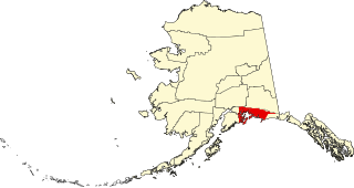
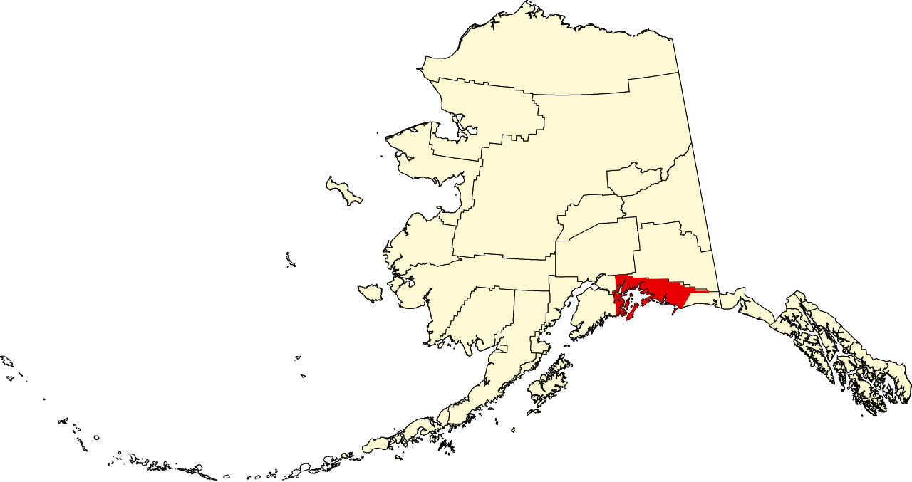
English: This is a locator map showing Chugach Census Area in Alaska - Provisional pending finalisation |
| 日期 | |
| 来源 |
自己的作品
|
| 作者 | KylieTastic |
| SVG开发 |
许可协议
我,本作品著作权人,特此采用以下许可协议发表本作品:
本文件采用知识共享署名-相同方式共享 4.0 国际许可协议授权。
- 您可以自由地:
- 共享 – 复制、发行并传播本作品
- 修改 – 改编作品
- 惟须遵守下列条件:
- 署名 – 您必须对作品进行署名,提供授权条款的链接,并说明是否对原始内容进行了更改。您可以用任何合理的方式来署名,但不得以任何方式表明许可人认可您或您的使用。
- 相同方式共享 – 如果您再混合、转换或者基于本作品进行创作,您必须以与原先许可协议相同或相兼容的许可协议分发您贡献的作品。
文件历史
点击某个日期/时间查看对应时刻的文件。
| 日期/时间 | 缩略图 | 大小 | 用户 | 备注 | |
|---|---|---|---|---|---|
| 当前 | 2020年2月29日 (六) 15:48 | | 1,470 × 777(402 KB) | KylieTastic | User created page with UploadWizard |
文件用途
以下页面使用本文件:
全域文件用途
以下其他wiki使用此文件:
- de.wikipedia.org上的用途
- en.wikipedia.org上的用途
- List of boroughs and census areas in Alaska
- Chenega, Alaska
- Cordova, Alaska
- Tatitlek, Alaska
- Valdez, Alaska
- Whittier, Alaska
- Evans Island
- Katalla, Alaska
- College Fjord
- Cape Saint Elias
- Unorganized Borough, Alaska
- Bering Glacier
- Chenega Glacier
- Chenega Island
- Miles Glacier
- Miles Lake
- Martin River Glacier
- Blueberry Hill (Alaska)
- Sargent Icefield
- Knik Glacier
- Montague Island (Alaska)
- Hawkins Island
- Knight Island (Alaska)
- Esther Island (Alaska)
- Culross Island
- Latouche Island
- Princeton Glacier
- Nassau Fjord
- Mount Michelson (Chugach Mountains)
- Template:Unorganized Borough, Alaska
- Nutzotin Mountains
- Bryn Mawr Glacier
- Harriman Glacier
- Crescent Glacier (Alaska)
- Dartmouth Glacier
- Downer Glacier
- Holyoke Glacier
- Smith Glacier (Alaska)
- Wellesley Glacier
- Williams Glacier
- Amherst Glacier
- Vassar Glacier
- User:Nyttend/County templates/AK
- Scott Glacier (Alaska)
- Worthington Glacier
- Category:Populated places in Unorganized Borough, Alaska
- User:25or6to4/nrhp1
- Eyak, Alaska
- Middleton Island
查看本文件的更多全域用途。