File:Map of Gettysburg, Adams County, Pennsylvania Highlighted.png

本预览的尺寸:800 × 551像素。 其他分辨率:320 × 220像素 | 640 × 441像素 | 1,024 × 705像素 | 1,280 × 881像素 | 1,688 × 1,162像素。
原始文件 (1,688 × 1,162像素,文件大小:50 KB,MIME类型:image/png)
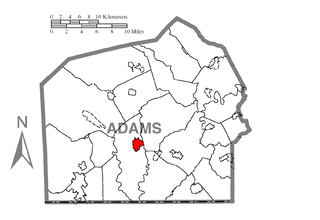
| 描述 | A map of Adams County showing Gettysburg, Pennsylvania (alternate) highlighted on the map. | |||
| 日期 | ||||
| 来源 | Source image taken from the United States Census Bureau's website pa_cosub.pdf. Image was modified by Ram-Man. | |||
| 作者 | (c)2006 Derek Ramsey (Ram-Man) (from U.S. Census Bureau source) | |||
| 授权 (二次使用本文件) |
A United States Census Bureau / Government work is in the public domain, however, my modifications are licensed as follows: You may NOT use this image on your own web site or anywhere else unless you release this image and any derivative works (e.g. your web site) by following the terms of one of the following licenses. Any other use will be considered a breach of copyright and I reserve the right of legal action. If you have not read the terms of these licenses or do not understand them, then do not use this image. 我,本作品著作权人,特此采用以下许可协议发表本作品:
您可以选择您需要的许可协议。 |
|||
| 其他版本 |
Image:Map of Adams County, Pennsylvania.png - Source map before highlighting (with text). Image:Map of Adams County, Pennsylvania No Text.png - Source map before highlighting (without text). |

文件历史
点击某个日期/时间查看对应时刻的文件。
| 日期/时间 | 缩略图 | 大小 | 用户 | 备注 | |
|---|---|---|---|---|---|
| 当前 | 2006年10月8日 (日) 00:43 | | 1,688 × 1,162(50 KB) | Ram-Man | {{Information| |Description=Map of Adams County showing a location highlighted. |Source=Source image taken from the United States Census Bureau's website [http://www2.census.gov/geo/maps/general_ref/cousub_outline/cen2k |
文件用途
没有页面链接到本图像。
全域文件用途
以下其他wiki使用此文件:
- ar.wikipedia.org上的用途
- ca.wikipedia.org上的用途
- ceb.wikipedia.org上的用途
- cy.wikipedia.org上的用途
- eo.wikipedia.org上的用途
- eu.wikipedia.org上的用途
- fa.wikipedia.org上的用途
- fr.wikipedia.org上的用途
- ht.wikipedia.org上的用途
- hu.wikipedia.org上的用途
- ko.wikipedia.org上的用途
- kw.wikipedia.org上的用途
- ro.wikipedia.org上的用途
- sh.wikipedia.org上的用途
- sr.wikipedia.org上的用途
- sv.wikipedia.org上的用途
- ta.wikipedia.org上的用途
- tt.wikipedia.org上的用途
- vi.wikipedia.org上的用途
- www.wikidata.org上的用途
- zh-min-nan.wikipedia.org上的用途