File:Map of Iraq, 1976.jpg

本预览的尺寸:621 × 599像素。 其他分辨率:249 × 240像素 | 497 × 480像素 | 796 × 768像素 | 1,064 × 1,027像素。
原始文件 (1,064 × 1,027像素,文件大小:395 KB,MIME类型:image/jpeg)
| 描述 |
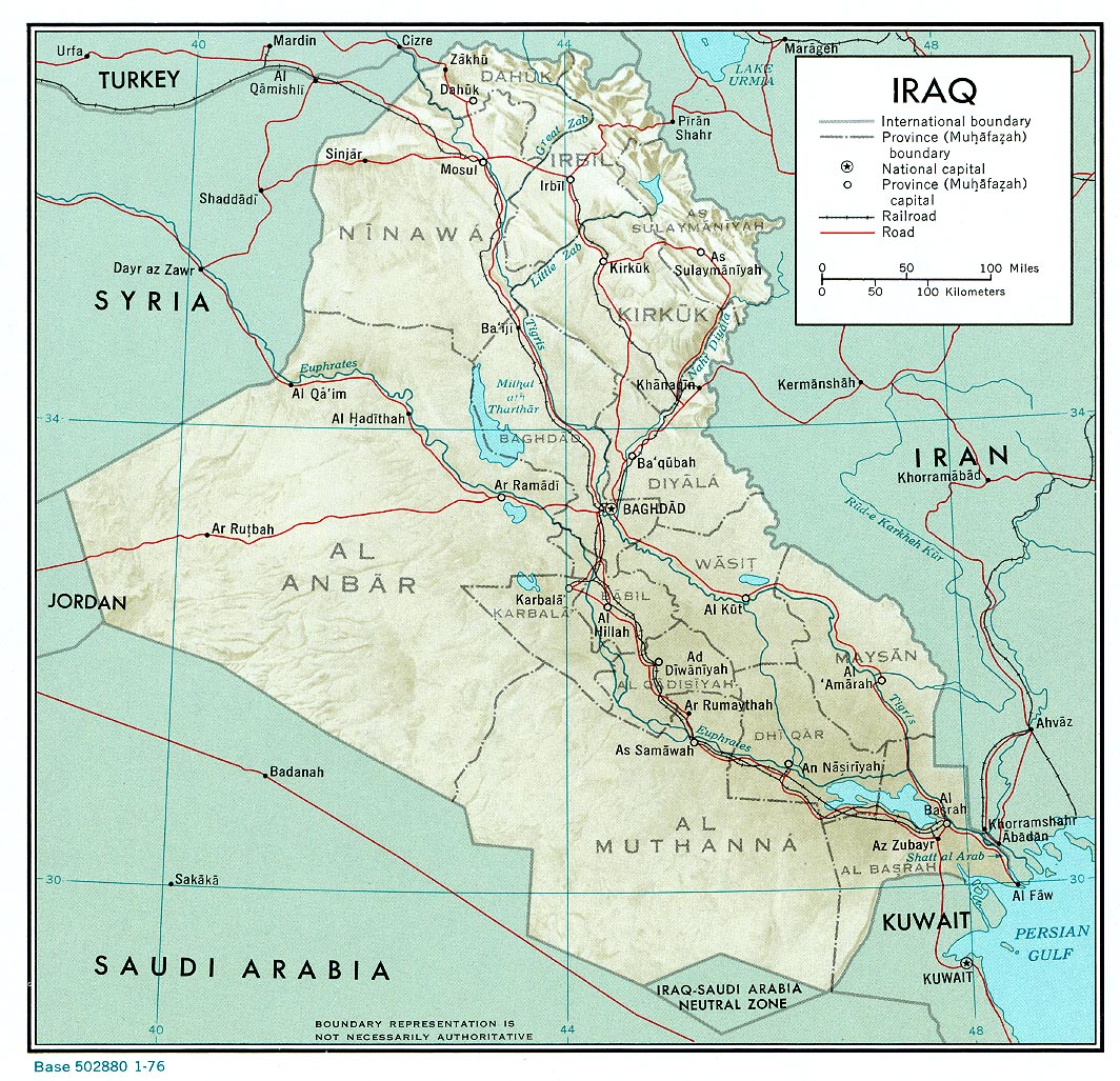
English: A map of Iraq, drawn in 1976. It shows the old province boundaries and other topographical detail. It is referred to here as a work of the CIA. |
|||
| 日期 | ||||
| 来源 | http://www.lib.utexas.edu/maps/middle_east_and_asia/iraq_rel_1976.jpg | |||
| 作者 | Employee(s) of the Central Intelligence Agency | |||
| 授权 (二次使用本文件) |
|
|||
| 其他版本 |
File:Neutralzone.jpg, cropped section of Neutral Zone. File:Map of Iraq, 1976-ar.jpg, in Arabic |

文件历史
点击某个日期/时间查看对应时刻的文件。
| 日期/时间 | 缩略图 | 大小 | 用户 | 备注 | |
|---|---|---|---|---|---|
| 当前 | 2010年6月11日 (五) 13:03 | | 1,064 × 1,027(395 KB) | Jarry1250 | {{Information |Description={{en|1=A map of Iraq, drawn in 1976. It shows the old province boundaries and other topographical detail. It is referred to [http://www.lib.utexas.edu/maps/iraq.html here] as a work of the CIA.}} |Source=http://www.lib.utexas. |
文件用途
全域文件用途
以下其他wiki使用此文件:
- ar.wikipedia.org上的用途
- en.wikipedia.org上的用途
- es.wikipedia.org上的用途
- fa.wikipedia.org上的用途