File:Map of New Mexico highlighting Luna County.svg

此SVG文件的PNG预览的大小:539 × 599像素。 其他分辨率:216 × 240像素 | 432 × 480像素 | 691 × 768像素 | 921 × 1,024像素 | 1,842 × 2,048像素 | 5,677 × 6,312像素。
原始文件 (SVG文件,尺寸为5,677 × 6,312像素,文件大小:31 KB)
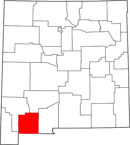
This is a locator map showing Luna County in New Mexico.
David Benbennick made this map. For more information, see Commons:United States county locator maps. Or see any of the New Mexico county locator maps: Bernalillo · Catron · Chaves · Cibola · Colfax · Curry · De Baca · Doña Ana · Eddy · Grant · Guadalupe · Harding · Hidalgo · Lea · Lincoln · Los Alamos · Luna · McKinley · Mora · Otero · Quay · Rio Arriba · Roosevelt · Sandoval · San Juan · San Miguel · Santa Fe · Sierra · Socorro · Taos · Torrance · Union · Valencia.
| 我,本作品著作权人,释出本作品至公有领域。这适用于全世界。 在一些国家这可能不合法;如果是这样的话,那么: 我无条件地授予任何人以任何目的使用本作品的权利,除非这些条件是法律规定所必需的。 |
文件历史
点击某个日期/时间查看对应时刻的文件。
| 日期/时间 | 缩略图 | 大小 | 用户 | 备注 | |
|---|---|---|---|---|---|
| 当前 | 2006年2月12日 (日) 15:30 | | 5,677 × 6,312(31 KB) | David Benbennick | {{subst:User:Dbenbenn/clm|county=Luna County|state=New Mexico|type=county}} |
文件用途
以下2个页面使用本文件:
全域文件用途
以下其他wiki使用此文件:
- ar.wikipedia.org上的用途
- bg.wikipedia.org上的用途
- bpy.wikipedia.org上的用途
- cdo.wikipedia.org上的用途
- ceb.wikipedia.org上的用途
- ce.wikipedia.org上的用途
- cy.wikipedia.org上的用途
- de.wikipedia.org上的用途
- en.wikipedia.org上的用途
- List of counties in New Mexico
- Luna County, New Mexico
- Columbus, New Mexico
- Gage, New Mexico
- Template:Luna County, New Mexico
- User:Nyttend/County templates/NM
- Deming, New Mexico
- Fort Sill Apache Tribe
- Category:Populated places in Luna County, New Mexico
- Mowry City, New Mexico
- Nutt, New Mexico
- National Register of Historic Places listings in Luna County, New Mexico
- City of the Sun, New Mexico
- Pecan Park, New Mexico
- Keeler Farm, New Mexico
- La Hacienda, New Mexico
- Mountain View, Luna County, New Mexico
- Cow Springs Ranch
- Pulpotio Bareas, New Mexico
- Sunshine, New Mexico
- Ventura, New Mexico
- Mimbres, Luna County, New Mexico
- User:AridCeption/sandbox
- Old Town, New Mexico
- es.wikipedia.org上的用途
- et.wikipedia.org上的用途
- eu.wikipedia.org上的用途
- fa.wikipedia.org上的用途
查看本文件的更多全域用途。