File:Mapa loc Arica y Parinacota.svg

此SVG文件的PNG预览的大小:400 × 600像素。 其他分辨率:160 × 240像素 | 320 × 480像素 | 512 × 768像素 | 682 × 1,024像素 | 1,365 × 2,048像素。
原始文件 (SVG文件,尺寸为400 × 600像素,文件大小:1.12 MB)
| 描述 |
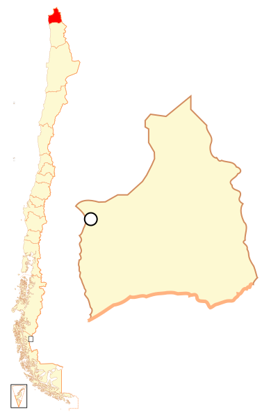
Español: Mapa localizador de la XV Región de Arica y Parinacota |
| 日期 | |
| 来源 | 自己的作品 |
| 作者 | B1mbo |
| 授权 (二次使用本文件) |
我,本作品著作权人,特此采用以下许可协议发表本作品: 本文件采用知识共享署名-相同方式共享 2.5 通用许可协议授权。
|
| Legal disclaimer
The edition and circulation of maps, geographic charts and other documents about the boundaries and frontiers of Chile, don't have any relation with the Republic of Chile, according to the Article 2 g) of DFL Nº83 of 1979 of the Ministery of Foreign Affairs. La edición y circulación de mapas, cartas geográficas y otros documentos sobre los límites y fronteras de Chile no tienen relación alguna con la República de Chile de acuerdo al artículo 2 g) del DFL Nº83 de 1979 del Ministerio de Relaciones Exteriores. |
文件历史
点击某个日期/时间查看对应时刻的文件。
| 日期/时间 | 缩略图 | 大小 | 用户 | 备注 | |
|---|---|---|---|---|---|
| 当前 | 2018年9月5日 (三) 22:36 | | 400 × 600(1.12 MB) | Janitoalevic | Ñuble Region |
| 2017年8月20日 (日) 23:14 |  | 400 × 600(1,019 KB) | Janitoalevic | Reverted to version as of 01:59, 6 October 2007 (UTC) | |
| 2017年8月20日 (日) 04:17 |  | 400 × 600(1.05 MB) | Janitoalevic | Added Ñuble Region | |
| 2007年10月6日 (六) 01:59 |  | 400 × 600(1,019 KB) | B1mbo | {{Information |Description= {{es|Mapa localizador de la XIV Región de Arica y Parinacota}} |Source=own work |Date=5 de octubre, 2007 |Author=B1mbo |Permission={{self|cc-by-sa-2.5}} |other_versions= |
文件用途
没有页面链接到本图像。
全域文件用途
以下其他wiki使用此文件:
- ba.wikipedia.org上的用途
- bg.wikipedia.org上的用途
- da.wikipedia.org上的用途
- de.wikipedia.org上的用途
- diq.wikipedia.org上的用途
- en.wikipedia.org上的用途
- es.wikipedia.org上的用途
- eu.wikipedia.org上的用途
- frr.wikipedia.org上的用途
- hr.wikipedia.org上的用途
- it.wikipedia.org上的用途
- ja.wikipedia.org上的用途
- ka.wikipedia.org上的用途
- ko.wikipedia.org上的用途
- lad.wikipedia.org上的用途
- lt.wikipedia.org上的用途
- nl.wikipedia.org上的用途
- no.wikipedia.org上的用途
- pl.wikipedia.org上的用途
- pt.wikipedia.org上的用途
- qu.wikipedia.org上的用途
- rm.wikipedia.org上的用途
查看本文件的更多全域用途。