File:Maricopa County METRO Light Rail Map.svg

此SVG文件的PNG预览的大小:650 × 550像素。 其他分辨率:284 × 240像素 | 567 × 480像素 | 908 × 768像素 | 1,210 × 1,024像素 | 2,420 × 2,048像素。
原始文件 (SVG文件,尺寸为650 × 550像素,文件大小:403 KB)
摘要
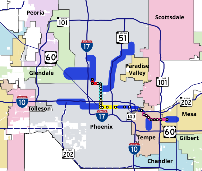
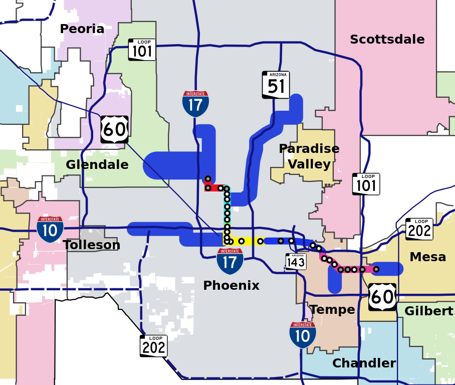
| 描述 | Geographical map of METRO Light Rail system of Phoenix, Arizona, showing the starter route and future expansion corridors. Also shown are city borders and highways in the vicinity of the light rail system. Stops are shown as white circles and park-and-ride stops are shown as gray circles. |
| 日期 | |
| 来源 | My own work, based off of maps from Valley Metro website (Light Rail Maps Page) |
| 作者 | en:User:Ixnayonthetimmay |
| 授权 (二次使用本文件) |
Public Domain |
许可协议
| 我,本作品著作权人,释出本作品至公有领域。这适用于全世界。 在一些国家这可能不合法;如果是这样的话,那么: 我无条件地授予任何人以任何目的使用本作品的权利,除非这些条件是法律规定所必需的。 |
文件历史
点击某个日期/时间查看对应时刻的文件。
| 日期/时间 | 缩略图 | 大小 | 用户 | 备注 | |
|---|---|---|---|---|---|
| 当前 | 2007年9月24日 (一) 03:31 | | 650 × 550(403 KB) | Ixnayonthetimmay | |
| 2007年9月24日 (一) 03:22 |  | 650 × 550(404 KB) | Ixnayonthetimmay | ||
| 2007年9月24日 (一) 03:19 |  | 650 × 550(403 KB) | Ixnayonthetimmay | ||
| 2007年9月24日 (一) 03:15 |  | 650 × 550(392 KB) | Ixnayonthetimmay | {{Information |Description=Geographical map of METRO Light Rail system of Phoenix, Arizona, showing the starter route and future expansion corridors. Also shown are city borders a |
文件用途
以下页面使用本文件:
全域文件用途
以下其他wiki使用此文件:
- en.wikipedia.org上的用途
- ja.wikipedia.org上的用途
- pl.wikipedia.org上的用途
- ru.wikipedia.org上的用途