File:Mars topography (MOLA dataset).png

本预览的尺寸:800 × 361像素。 其他分辨率:320 × 144像素 | 640 × 289像素 | 1,024 × 462像素 | 1,280 × 578像素 | 2,880 × 1,300像素。
原始文件 (2,880 × 1,300像素,文件大小:2.24 MB,MIME类型:image/png)
.png?uselang=zh)
.png?uselang=zh)
.png?action=history&uselang=zh)
.png)
摘要
| 描述 |
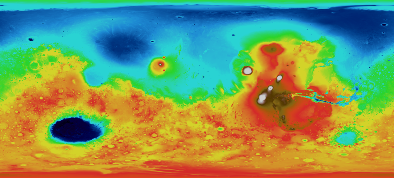
English: This map depicts topography, or surface features, of the planet Mars. In this image, white and red features are highest in relative elevation, while green and blue areas are lowest. This image was made possible by data from the Mars Orbiter Laser Altimeter (MOLA), which bounced a laser off the surface of the planet and calculated the distance traveled by the beam of light. |
| 日期 | Data collected in 2000 |
| 来源 | |
| 作者 |
NASA - Goddard Space Flight Center |
| 其他版本 |
.png) .png) |
.jpg)
许可协议
| 本文件完全由NASA创作,在美国属于公有领域。根据NASA的版权方针,NASA的材料除非另有声明否则不受版权保护。(参见Template:PD-USGov/zh、NASA版权方针页面或JPL图片使用方针。) | ||
 |
警告:
|
文件历史
点击某个日期/时间查看对应时刻的文件。
| 日期/时间 | 缩略图 | 大小 | 用户 | 备注 | |
|---|---|---|---|---|---|
| 当前 | 2009年3月4日 (三) 20:49 | | 2,880 × 1,300(2.24 MB) | Tryphon | Gimp messed the colors up somehow, converting from TIFF to PNG; this one was converted using Imagemagick and seems fine. |
| 2009年3月4日 (三) 20:23 |  | 2,880 × 1,300(2.13 MB) | Tryphon | == Summary == {{Information |Description={{en|1=This map depicts topography, or surface features. In this image, white and red features are highest in relative elevation, while green and blue areas are lowest. This image was made possible by data from the |
文件用途
全域文件用途
以下其他wiki使用此文件:
- fr.wikipedia.org上的用途
- fr.wikibooks.org上的用途
.png)