File:MedwayM2OverRochesterChathamKingsnorth9936.JPG

本预览的尺寸:800 × 600像素。 其他分辨率:320 × 240像素 | 640 × 480像素 | 1,024 × 768像素 | 1,280 × 960像素 | 2,016 × 1,512像素。
原始文件 (2,016 × 1,512像素,文件大小:813 KB,MIME类型:image/jpeg)
摘要
| 描述 |
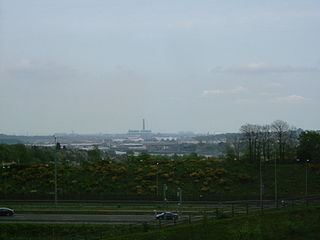
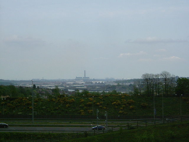
A view over Medway from Merrall's Shaw, Ranscombe Farm, Cuxton. In the foregrounfd is the M2 motorway, then there is Rochester Bridge , with the castle obscured by trees. The next roofs are those of the covered slips at Chatham Dockyard, then there is the power station at Kingsnorth, and behind and to the left the power stations at Grain, and the Thames estuary.
|
||||
| 日期 | |||||
| 来源 | 自己的作品 | ||||
| 作者 | ClemRutter |
许可协议
我,本作品著作权人,特此采用以下许可协议发表本作品:

|
已授权您依据自由软件基金会发行的无固定段落及封面封底文字(Invariant Sections, Front-Cover Texts, and Back-Cover Texts)的GNU自由文件许可协议1.2版或任意后续版本的条款,复制、传播和/或修改本文件。该协议的副本请见“GNU Free Documentation License”。 |
| 本文件采用知识共享署名-相同方式共享 3.0 未本地化版本许可协议授权。 | ||
| ||
| 本许可协议标签作为GFDL许可协议更新的组成部分被添加至本文件。 |
您可以选择您需要的许可协议。
文件历史
点击某个日期/时间查看对应时刻的文件。
| 日期/时间 | 缩略图 | 大小 | 用户 | 备注 | |
|---|---|---|---|---|---|
| 当前 | 2007年4月25日 (三) 21:52 | | 2,016 × 1,512(813 KB) | ClemRutter | {{Information |Description=A view over Medway from Merrall's Shaw, Ranscombe Farm, Cuxton. In the foregrounfd is the M2 motorway, then there is Rochester Bridge , with the castle obscured by trees. The next roofs are those of the covered slips at Chath |
文件用途
以下页面使用本文件:
全域文件用途
以下其他wiki使用此文件:
- br.wikipedia.org上的用途
- ca.wikipedia.org上的用途
- ceb.wikipedia.org上的用途
- cy.wikipedia.org上的用途
- da.wikipedia.org上的用途
- eo.wikipedia.org上的用途
- fa.wikipedia.org上的用途
- frr.wikipedia.org上的用途
- ga.wikipedia.org上的用途
- it.wikipedia.org上的用途
- no.wikipedia.org上的用途
- pl.wikipedia.org上的用途
- ro.wikipedia.org上的用途
- ru.wikipedia.org上的用途
- sv.wikipedia.org上的用途
- ur.wikipedia.org上的用途
- www.wikidata.org上的用途